Category Archives: trips

Passage from Hell: Crossing Hecate Strait from Haida Gwaii to Milbanke Sound

As the roar of the breaker came up behind my shoulder I looked back to see green water curling towards our stern. *Boom!* The wave smacked the side of the hull. In the next instant the wave top crashed into the cockpit, sending gallons of cold water over me and immersing my feet ankle deep.

My jacket, pants and sneakers were drenched, and the water slowly drained. No time to worry about that though, as I steered to ride the wave down. This wasn’t the first breaker we’d had that day but it was the one that caught us the worst.

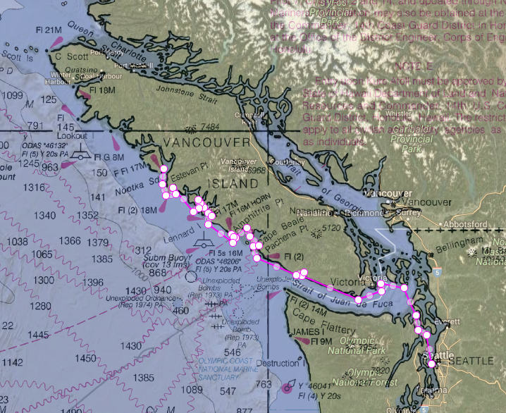
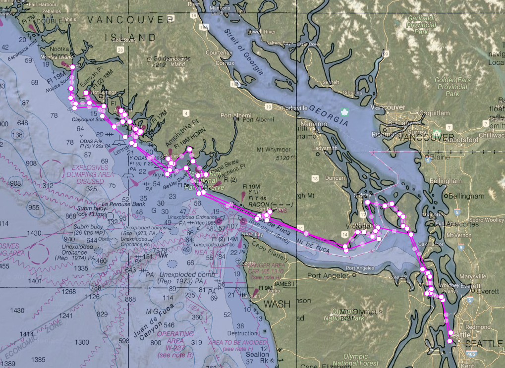
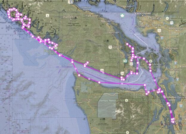
It was June 15 and we were crossing Hecate Strait from the south of Haida Gwaii to the Central Coast of BC. With a forecast of NW 20-30 we thought we’d have a tough but manageable day, but ended up having a steady 30-35 knots and 6 to 14 foot waves at a 6-7 second interval (very short interval, with confused tidal interactions in some places).

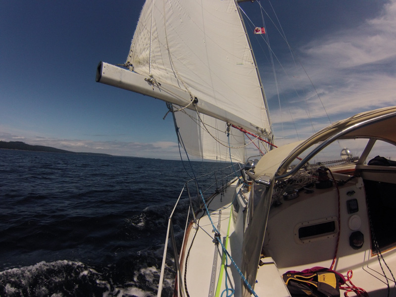
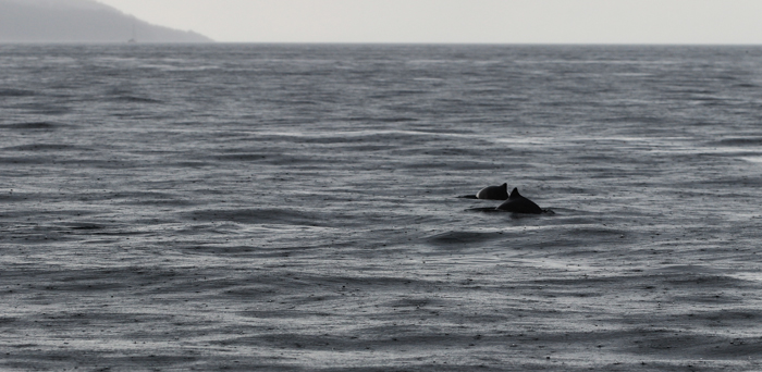
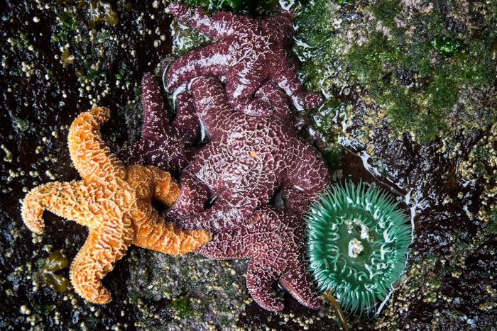
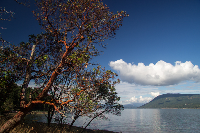
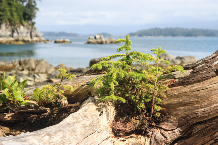
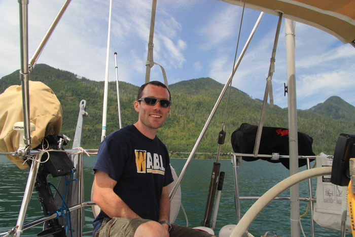
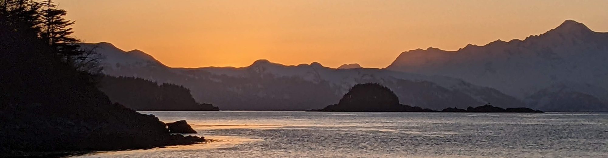
Apologies that I don’t have many pictures, but conditions were way too difficult to spend time doing photography. All photos except for one were taken before 10am, in the relatively easier conditions.

IMG_5793

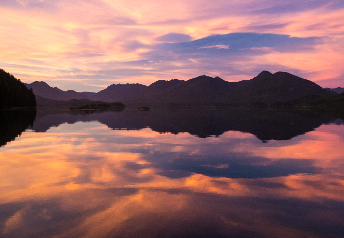
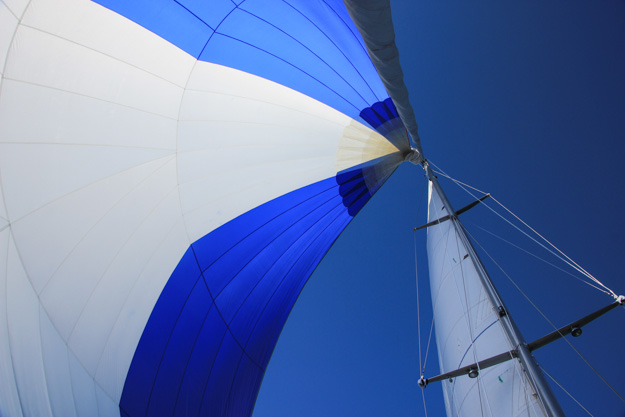
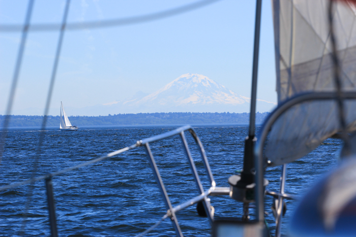
Sailing into the sunrise, 6am. The best sailing of the day was done by 9am!

Stats

    • Hours: 18 1/2 hours; June 15 2018, 4:30am – 11pm

      Sailed: 17 1/4 hours, Motored: 1 1/4 hours

    • Straight-line distance: 90 nautical miles
    • Distance covered: 104 nautical miles

      Covered under sail: 97 nm, Covered by motor: 7 nm

  • Wind range: NW 5-15 (10% of passage), NW 15-25 (5% of passage), NW 30-35 (80% of passage), NW 20-25 (5% of passage)
  • Wave state range: 3 ft (near Haida Gwaii), 6 ft, 9 – 12 ft, confused tidal interactions, confused swell + wind wave interactions.
  • Waves as measured by South Hecate buoy: 2.3m (7.5 ft) significant wave height at 5:30pm, 6 second period. Maximum zero crossing wave height 4.3m (14 ft).
  • Sail configurations: full sails (main + 135% genoa), reefed main + full genoa, double reefed main + full genoa, double reefed main + double reefed genoa, double reefed main + staysail, staysail alone, double reefed genoa alone, full genoa.
  • # Sail config changes: 9
  • Autopilot usage: ~40%; 8-12 hours of hand steering
  • Boats seen: 1 (cargo vessel)
  • Seasickness preventatives: Patrick: Sea-bands, 1 Bonine; Natalie: 1 Bonine
  • # of times we wished we were someplace else: Too many to count
Screenshot_20180615-230100

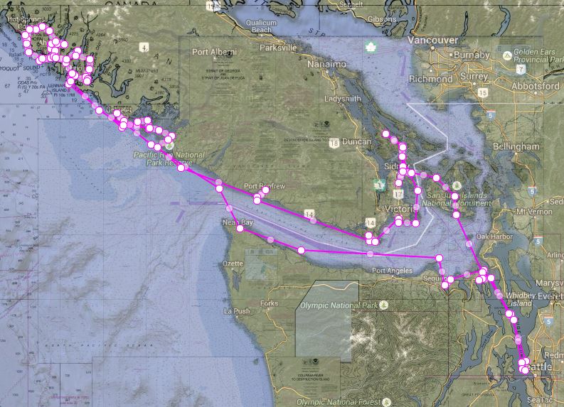
Route across Hecate Strait (purple line is the rhumbline – straightest course – and yellow is our actual course). We initially stayed close to the rhumbline or headed up above it (because we knew building winds would force us more downwind). The part where we were forced off the rhumbline was mostly 30-35 kts with staysail alone, and the turn where we pointed more northeasterly is where we decided to try to make Milbanke Sound.

Continue reading

Month 2 Cruising Summary: Sailing from the Octopus Islands to Haida Gwaii

When cruising for a long time, there’s a risk of becoming jaded – after countless beautiful anchorages and waterways ringed by snow capped mountains, eagles calling overhead, it can start to feel the same. When this starts to happen I remind myself how lucky we are to be cruising in one of the best areas of the world, and any jaded feelings quickly fall away.

Even though we sail through a seemingly repetitive slideshow of evergreen forests, panoramic vistas, sea life, mountains, and pristine water, there’s always something new happening to break you out of any affectation of beautiful monotony. Perhaps a rare clear night where you see more stars than you’ve ever seen in your life. A humpback quietly surfacing near your boat, or a riveting downwind sail.

The cruising life has its hard moments, but it’s rarely boring. While cruising we’re more connected with nature than we ever were in the city. It feels like long ago that we cast off the lines from our live-aboard community at Shilshole, but it’s only been two months.

In month one, we traveled from Seattle to the Octopus Islands near Campbell River, BC. In the last month, we’ve come a long way: from the Octopus Islands to Haida Gwaii.

We relaxed in the Octopus Islands, got lucky with a fantastic quick passage of Johnstone Strait, hung out in the Broughtons for a bit, and then rounded Cape Caution. Going around Cape Caution was hard, but then we had awesome, easy sunny days on the Central Coast.

From Shearwater we headed up the North Coast of BC, and had a very rainy 3 days stay at Clark Cove waiting out a gale. Our luck with wind ran out and we had a slow, frustrating crossing of Hecate Strait to Haida Gwaii.

May Route Summary-OpenCPN

Approximate route (follow the blue line).

Continue reading

Costs and Impressions of Traveling in Thailand for 2 Weeks

I’m never sure whether readers of our blog are interested in hearing about travels we do off the sailboat – like Mexico last year. But since Thailand is a pretty major cruiser destination, I figure it might be of interest.

We flew to Thailand the day after Christmas for a two week vacation, visiting Bangkok for 5 days, Patong Beach in Phuket for 3 days, Phi Phi island for 3 days, and Naiyang Beach, Phuket for the final day. 2 full days were consumed by the plane travel from Seattle (22-24 hours travel time).

Of course, I viewed much of Thailand thru the perspective of sailing and other cruisers’ experiences there. Delos has been to the Phi Phi islands that we visited on our trip (Delos in Southern Thailand and Phi Phi Islands).  The prior-prior owner of our boat actually bought it to sail to Thailand, and after a year of prep work decided it’d be easier to fly there and charter. I’m inclined to agree.

We rewatched the Delos episode. It was really interesting seeing our different perspective on it this time. It still looked awesome and fun, but we could see all the things they had omitted. They avoided the most touristy bay, briefly mentioned the party beach’s loud music keeping them up at night while at anchor (a 5-second clip that would be easy to miss), and snuck into a park that charges a high tourism fee (I think they said 300 baht, but it’s 400 baht now).

I don’t blame them – they’re catering to their audience, most of whom are not going to sail to Thailand, or necessarily anywhere else. Those people only want to see the fun times, and discussing practicalities won’t get you a quarter million followers on YouTube.

Phi Phi Leh

Continue reading

Trip Summary: West Coast Vancouver Island

This year’s 1-month cruise took us from Seattle all the way to Nootka Sound, more than half way up Vancouver Island’s west coast.

Starting from Seattle, we had an upwind slog getting out the eastern Strait of Juan de Fuca to Victoria, followed by a relaxing five days exploring Barkley Sound’s quiet anchorages. We next went up to Clayoquot Sound (after one false start due to awful wave conditions). We didn’t stay long in Clayoquot, heading up to Nootka Sound to see how far we could get. We had fun exploring Friendly Cove, but someday will have to come back when we have more time to explore Nootka.

It was time to turn around back south, so we headed to Tofino and picked up an unwelcome stowaway for one night. We stopped in Barkley Sound again, regretting we didn’t have more time to stay in this most epic of sounds, and headed back down the Strait of Juan de Fuca. Fortunately we had some time to relax in Victoria, checking out some anchorages we normally wouldn’t have time for.  Passing through the San Juans they were as beautiful as always, but sadly it was soon time to return to Seattle.


A month sounds like a lot of time, but it’s really not, at least not when you’re trying to cover ground by sail. About 3 weeks in we realized we had packed the schedule a bit too tight, and probably shouldn’t have stretched to go to Nootka Sound. While it was cool to reach our farthest point north on the west coast ever, we had many long and tiring days and not quite enough short days or lay days.

It’s important to have balance in a cruising schedule. I often think of it like a video game – if you always have the difficulty setting on “hard”, you’ll get burnt out. Most days going up the west coast are medium or hard difficulty, so we needed a few more easy days in the mix. Fortunately the last week, in the Victoria area and San Juans, provided some nice easy days.

View of our route with the return leg plotted as well.

Stats:

  • Nights at anchor: 27
  • Nights in a marina: 3
  • # times stern tied: 0
  • Distance Traveled, as the motor boat travels: 600 nautical miles
  • Distance Traveled, as sailed (approximated): 800-900 nautical miles
  • % time spent sailing (approx): 75%
  • % distance spent sailing (approx): 50%

Continue reading

Setting Sail for the West Coast of Vancouver Island

Tonight we cast off the lines for our third annual summer cruise, following a similar route to the one we did two years ago up the west coast of Vancouver Island. It’s hard not to be overwhelmed with excitement, but we also know there are some challenging waters ahead of us. Our first big cruise two years ago was a bit of a reality check, making us aware that ocean waves can be much more difficult than we expected, and that some of our sailing skills weren’t quite as good as we thought (in particular, we had little high wind experience).

We’re hoping this time it will go a lot better. Besides having a great deal more experience, the boat is in better shape now – having 2 ½ years worth of projects done rather than just 6 months worth. Two problems that stressed us last time – engine troubles in the Strait of Juan de Fuca, and a gradual transmission failure – shouldn’t happen again.

Things have been really busy the last month – after moving aboard (becoming full-time liveaboards) there was a flurry of projects and chores to complete, along with some great sailing to the San Juans and a couple local destinations. So I don’t really have much time to write more about our planned trip, and will just refer back to this post from two years ago for our approximate route. This time however, we’ll be going up the Canadian side – Victoria to Becher Bay to Port Renfrew to Bamfield.

VancouverIsland

IMG_2046

Fishing in Puerto Vallarta

“Fish on!” was called out across the boat. It was my turn in the fighting chair – 9th in a lineup of 9 on our charter in the Bay of Banderas. Everyone else had caught yellowfin tuna, so I was expecting that was what was on the line. But immediately it was clear this was something very different. The line on the spool started running – fast. The spool was at max tension, but it did nothing to slow this fish as it dove deeper and deeper. The two Mexican crew running the boat looked at each other and started speaking in Spanish, too fast for me to understand. El marlin negra – black marlin – is what they think was on the line.

Black marlin can grow to 10+ feet in length and hundreds of pounds – a whole different story than the 20-40 lb 3’ yellowfin tuna. The captain stopped the boat and they told me to go slow, a long fight was on my hands.

The fish kept running – 100 feet, 200 feet, maybe 300 feet of line spooled out. The line was going straight down, and was so tight you could play piano notes on it. As he kept running we started worrying the spool was going to run out of line. Finally he stopped and I worked hard to bring that line back in. It was a full body work-out pulling the rod up and then coming down, cranking the spool hard, repeated again and again.

Then the fish started running again, careening way off to the side, and the line started running out – losing 100-200 feet or so of my progress. At times I could only stop and rest, shaking my numbed arms to bring some life back into them. I was out of breath and drenched in sweat. This was more of a workout than I imagined fishing could possibly be.

Eventually I passed the torch to the next in the line-up – Natalie – and she fought the fish for a while. In the end, four different people took a turn, but as we were transferring to the 4th person, the marlin (we think) snapped the lead on the line, and we came up empty handed. It sure would’ve been great to see what it was. But, the experience was worth it in itself, and we had some delicious yellowfin tuna for dinner that night.

Continue reading

Summarizing 3 Months of Cruising – Part 2 of 2

In Part 1 of this post, we summarized our route, trip stats, and the wind and weather conditions we experienced. In this part we’ll describe the sailing a bit more, wildlife, and what went wrong (or didn’t) with our boat.

As inevitably happens on a 3 month trip, some equipment breaks or starts acting up – it’s Murphy’s Law of the sea. But while cruising we quickly learned to focus on only the things that actually matter. You get good at prioritizing really quickly. We had to conserve our energy because most of it went towards sailing the boat during the day.

Now back on shore, some of the problems we worry about in day-to-day life seem trivial in comparison. I heard a Clipper racer recently said:

I think I’m doing this because life has become too easy.”

That’s a good way of explaining the difference between shore life and life at sea. While cruising, the challenges are real, and have a direct connection with your safety, health, or comfort. Long-term sailing makes you realize how easy, cushy and soft our lives have become in modern times.

img_2989

img_3406

Sailing Tactics

As the wind levels mentioned previously show, if we didn’t sail in 4-10 knot winds, we would’ve done very little sailing. We found our sailing became very tactical this year. It was like a constant chess match with the wind – trying to make sure we left anchor at the right time, were sailing with the wind if possible, didn’t sail ourselves into wind holes, and watched for puffs of better air on the water.

We used the spinnaker, our storm staysail, and nearly every reefing configuration we have for the main and genoa.

But what was more important than which sails we had was having patience and flexibility. The patience to wait for wind, and the flexibility to not sail to a schedule were the two key factors that enabled us to sail more.

We averaged 5 gallons of diesel per week. We have a 16 gallon diesel tank plus up to 10 gallons in jerry cans, so we had enough we could’ve gone a month without filling up in theory – but never risked going below 50%. About 2-3 times per week we sailed onto or off of anchor. It’s not often possible to do that, but when it was we liked to just for fun – it was good practice of a new sailing skill, and gave us confidence we’d still be okay if our engine failed going into an anchorage.

Continue reading

Summarizing 3 Months of Cruising (Part 1 of 2)

How do you describe three months of sailing? The truth is you can’t – no words can really sum up that amount of time in a short blog post. We had such an amazing time that to say it was life changing wouldn’t be much of an exaggeration.

Some areas of remote BC were more beautiful than I could adequately put into words. We had surprise visits from humpback whales, seals and bears, reminding us we were not the only life out there. We encountered high winds and strong currents, situations that tested our boat’s strength, and our abilities as sailors.

My relationship with wind changed – I can’t look at water now without seeing wind – the ripples and the tidal interactions. A flag blowing on a hill side, or a gentle breeze on your arm. So many signals we used to read wind; wind started to become a kind of three dimensional map on the water, or a 6th dimension to our senses.

Wind was our motive force, our fuel – for this reason it reached a greater importance than ever before. We had a lot of mileage to cover, and most of it was wind powered.

All the stress of packing up our condo, selling or donating excess possessions, finishing last minute boat projects, and moving onto the boat had long since been forgotten – erased by the single minded focus you get while cruising. The only thing that mattered was keeping the boat moving and keeping us safe. Fun was a secondary goal, and as long as we were safe, it usually came easily.

img_2903

Anchored in front of the waterfall in Princess Louisa Inlet.

Route

Our route took us over 1300 nautical miles, starting June 10 from Seattle at Elliot Bay Marina, and ending September 3 back in Seattle at Shilshole.

We first headed north to the San Juans, and spent a week or two there (meeting up with family), then traveled through the southern Gulf Islands before hopping over to the Sunshine Coast and visiting Princess Louisa Inlet.

From there we headed north for some sunshine and warm water in Desolation Sound. Next we traveled through the back route to the Broughtons, bypassing most of Johnstone Strait but still dealing with the high currents of the tidal passes and some high winds once we reached Johnstone.

After reprovisioning at Port McNeil, we skipped past the Broughtons because we had southerly wind, and explored Queen Charlotte Strait. Miles Inlet was our furthest point north, almost to Cape Caution, at which point we headed back south and spent over a week in the Broughtons. The highlight of that area was sailing into MacKenzie Sound and visiting Nimmo Bay Resort.

We were a little tired of all the powerboats in the Broughtons and the mostly overcast, chilly days, so we headed south back through Johnstone Strait (all the way this time) and returned to Desolation Sound. Desolation Sound was hot and sunny by this time (late July), but also very crowded – we found a wonderful, more secluded spot in Pendrell Sound.

As we continued south, we visited Lasqueti Island, and went across the Strait of Georgia to Nanaimo and the northern Gulfs. Later we went across the Strait again to visit Vancouver for several days, and then crossed the Strait back westward (encountering high winds this time), to visit the Gulf Islands some more. We enjoyed the Gulfs, but before long it was time to move on – back to the U.S. through the San Juans.

We stopped in Port Townsend and then sailed south, past Seattle, to southern Puget Sound. Despite a complete lack of wind most of the time, we had fun visiting Natalie’s family in Olympia. From there we headed back to anchorages around Seattle and Bainbridge for a few nights, before it was time to truly end our trip and return to work.

img_2956

Looking west, on the way to Desolation Sound.

Continue reading

Crossing the Strait of Georgia in a Southerly

As the waves settled out a bit from their previous roar, we said (for the fourth time), “Things are looking better now.” No sooner had we said that than another series of rollers came along. The boat rolled from toerail to toerail. We could hear the wave coming by the roar of the breaker. Breaking waves don’t normally happen outside the ocean, but minor ones do happen when you have 3-4 foot waves at 3 seconds.

Each time bigger waves hit our stern quarter, the wave crest would push the boat’s stern, causing us to start to round up – in 20 knot winds. So I have to anticipate every wave and react quickly and forcefully with steering. As a wave lifts us up, the boat surfs and we drive down it. We’re doing 7 knots at times, under a single reefed main and no foresail.

We were in the Strait of Georgia – a seemingly routine waterway east of Nanaimo – heading from Porlier Pass in the Gulf Islands to Pender Harbor, on Tuesday. We knew we’d have a flood current with a southerly wind – two good things, since you want wind following current, and the wind here is usually not southerly, but southerly allows us to sail downwind which is much easier than upwind in choppy waves. We expected a downwind sleigh ride. But it wasn’t working out as well as hoped – high wind is manageable, but the short steep swell was an issue.

DCIM100GOPRO

Easy sailing – We began the crossing with 10 kts, on a broad reach

Continue reading

West Coast Vancouver Island – Trip Summary

Last week we got back from our 4-week trip out the Strait of Juan de Fuca, up the west coast of Vancouver Island to Barkley and Clayoquot Sounds, back through the Strait to Victoria, around the Gulf Islands a couple days, and then back to Seattle.

This was about 600 nautical miles, but that’s just the straight line distance – with tacking and jibing when we were sailing, we probably did closer to 800.

Overall route (not all circles represent stops, those are just the points where I needed to change the route line direction)

Overall route (not all circles represent stops, those are just the points where I needed to change the route line direction)

Detailed route of Barkley and Clayoquot Sounds.

Detailed route of Barkley and Clayoquot Sounds.

As cruisers often say, the highs were very high and the lows very low. Cruising is often more intense, in both the good and the bad, than land life. Our two biggest problems were mechanical – the fuel filter clogging in the Strait of Juan de Fuca, and the transmission progressively failing. There were human challenges too – dealing with very tiring passages, mild seasickness, difficulties in confused ocean waves, challenges controlling the sails in high winds, and almost swinging into rocks at anchor.

Despite the challenges, I feel we did quite well. We didn’t have any failures of seamanship – no groundings, no navigational mistakes, no anchor dragging, no poor timing of weather, no docking mishaps.

There were hard times, but for this post I want to focus on the fun times – all the amazing experiences and especially the great photos I got.

Stream-fed bathing pool at Matilda Inlet

Stream-fed bathing pool at Matilda Inlet

IMG_1932

Anchored in Matilda Inlet (our favorite anchorage of the trip)

Wildlife

The trip was not a roadside safari, yet we saw plenty of wildlife.

  • Whales – a gray whale while we were sailing south of Hot Springs Cove in large, confused seas, and a small whale near Effingham Bay that actually breached (jumped out of the water)!
  • Bears – two separate sightings of black bears on Vancouver Island from Clayoquot Sound.
  • Orcas – multiple groups in one sighting in Becher Bay near Victoria. There were several whale watching boats following them.
  • Pregnant sea otter? Offshore of Barkley Sound we saw a sea otter curled into a fetal position on her back, feet sticking straight into the air – we thought she must either be giving birth, or sick. It was the oddest sight, randomly a couple miles offshore in ocean waves.
  • Lots and lots of eagles. My favorite was in Tofino when a male bald eagle carrying a salmon head in his claws flew right in front of me only about 15 feet away.

IMG_1974

  • Seals (of course).
  • A raccoon just a few feet off the trail on Portland Island.

IMG_2112 IMG_1855

Great Hikes

  • Portland Island (aka Princess Margaret island, part of the Gulf Islands national park) – this was probably our favorite sailboat-accessed hike yet – about a 6 km trail running around the island that had great views the whole way and interesting vegetation and scenery – lots of photo ops.
Portland Island

Portland Island

  • Effingham Bay – I did this hike twice, once with Natalie and once with Kristina and Scott from Seattle. It’s an easy hike with a great beach, and when Natalie and I did it we went to the sea cave. The cave would be fun to explore further with a flashlight.

IMG_2068

The sea cave at Effingham Island

The sea cave at Effingham Island

  • Hot Springs Cove – this is an easy hike on a boardwalk, with a natural hot springs at the end as reward!
Hiking to the hot springs

Hiking to the hot springs

  • Bamfield Boardwalk – it’s a stretch to call this a hike, but Bamfield was super cute – especially the dogs!

IMG_2072 IMG_2078


IMG_2020

Arrived in Victoria and docked in front of the Empress Hotel

Arrived in Victoria and docked in front of the Empress Hotel

Our last day - with a failing transmission but a 12 knot wind at our backs, I pointed the bow pointed at Mount Rainier and we sailed home.

Our last day – with a failing transmission but a 12 knot wind at our backs, I pointed the bow pointed at Mount Rainier and we sailed home.