How do you describe three months of sailing? The truth is you can’t – no words can really sum up that amount of time in a short blog post. We had such an amazing time that to say it was life changing wouldn’t be much of an exaggeration.
Some areas of remote BC were more beautiful than I could adequately put into words. We had surprise visits from humpback whales, seals and bears, reminding us we were not the only life out there. We encountered high winds and strong currents, situations that tested our boat’s strength, and our abilities as sailors.
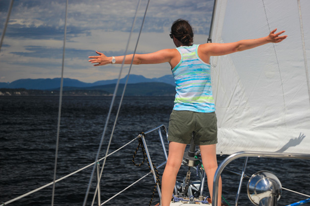
My relationship with wind changed – I can’t look at water now without seeing wind – the ripples and the tidal interactions. A flag blowing on a hill side, or a gentle breeze on your arm. So many signals we used to read wind; wind started to become a kind of three dimensional map on the water, or a 6th dimension to our senses.
Wind was our motive force, our fuel – for this reason it reached a greater importance than ever before. We had a lot of mileage to cover, and most of it was wind powered.
All the stress of packing up our condo, selling or donating excess possessions, finishing last minute boat projects, and moving onto the boat had long since been forgotten – erased by the single minded focus you get while cruising. The only thing that mattered was keeping the boat moving and keeping us safe. Fun was a secondary goal, and as long as we were safe, it usually came easily.
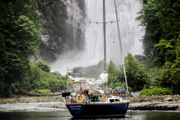
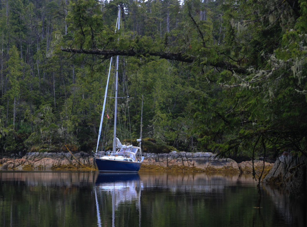
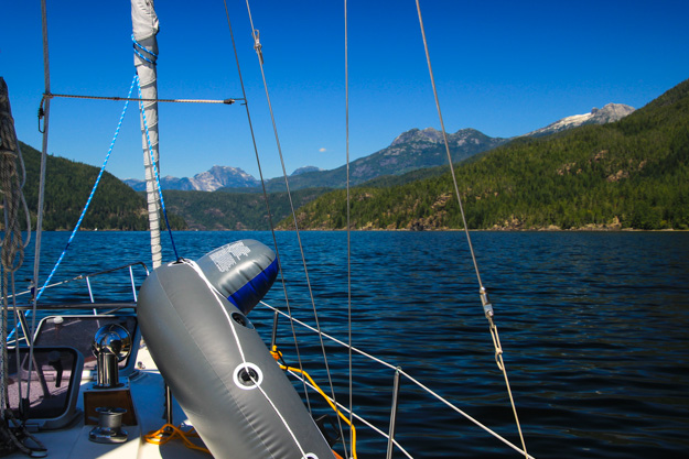
Anchored in front of the waterfall in Princess Louisa Inlet.
Route
Our route took us over 1300 nautical miles, starting June 10 from Seattle at Elliot Bay Marina, and ending September 3 back in Seattle at Shilshole.
We first headed north to the San Juans, and spent a week or two there (meeting up with family), then traveled through the southern Gulf Islands before hopping over to the Sunshine Coast and visiting Princess Louisa Inlet.
From there we headed north for some sunshine and warm water in Desolation Sound. Next we traveled through the back route to the Broughtons, bypassing most of Johnstone Strait but still dealing with the high currents of the tidal passes and some high winds once we reached Johnstone.
After reprovisioning at Port McNeil, we skipped past the Broughtons because we had southerly wind, and explored Queen Charlotte Strait. Miles Inlet was our furthest point north, almost to Cape Caution, at which point we headed back south and spent over a week in the Broughtons. The highlight of that area was sailing into MacKenzie Sound and visiting Nimmo Bay Resort.
We were a little tired of all the powerboats in the Broughtons and the mostly overcast, chilly days, so we headed south back through Johnstone Strait (all the way this time) and returned to Desolation Sound. Desolation Sound was hot and sunny by this time (late July), but also very crowded – we found a wonderful, more secluded spot in Pendrell Sound.
As we continued south, we visited Lasqueti Island, and went across the Strait of Georgia to Nanaimo and the northern Gulfs. Later we went across the Strait again to visit Vancouver for several days, and then crossed the Strait back westward (encountering high winds this time), to visit the Gulf Islands some more. We enjoyed the Gulfs, but before long it was time to move on – back to the U.S. through the San Juans.
We stopped in Port Townsend and then sailed south, past Seattle, to southern Puget Sound. Despite a complete lack of wind most of the time, we had fun visiting Natalie’s family in Olympia. From there we headed back to anchorages around Seattle and Bainbridge for a few nights, before it was time to truly end our trip and return to work.
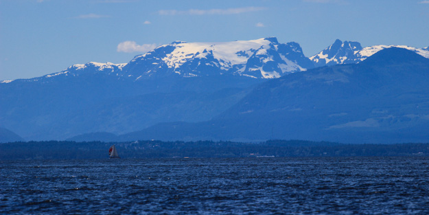
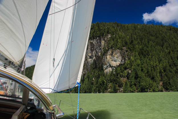
Looking west, on the way to Desolation Sound.
Trip Stats
- Duration: 85 days (June 10 – Sept 3)
- Nights at anchor: 70
- Nights in a marina: 15 (goal was one marina stay per week)
- Distance Traveled: ~1300 nautical miles, straight line distance (as the motor boat motors) – with sailing it was probably closer to 1600-1800.
- Total engine hours: 123 (10 hrs per week, 1.4 hrs per day)
- Diesel used: 62 gallons (5 gallons per week)
- Water used: 3-4 gallons per day. Our 29 gallon tank typically lasted 7-9 days.
- Electrical use: ~20 Ah per day in the first 1.5 months, before we replaced our batteries, and after that about 20-40 Ah per day.
- Peak wind speed while sailing: 28 knots
- Peak wind speed at anchor: 25 knots
- Peak boat speed over ground: 10 knots (Seymour Narrows, sailing, with 3-4 knot push)
Time
Having 3 months was a wonderful advantage. It meant we didn’t have to rush through places we liked, could time our passages to wind and weather, and could do shorter distances – which means more sailing rather than motoring. 3 months was just about right, but in the 3rd month we started missing some of the niceties of shore life – restaurants, Internet, a bed with more leg room than cramped sailboat berths, etc.
So it worked out well that we spent most of our third month near more populated areas like Vancouver, Port Townsend, Seattle, and Olympia. If we had more than 2 months in remote areas of BC, I think it might have been too much.
Anchored in Miles Inlet, northeastern Queen Charlotte Strait.
Wind
We had surprisingly good wind this summer, and did a lot of downwind sailing – probably 50% of our sailing mileage was downwind. We also sailed more mileage than we motored, which is pretty hard to do in the PNW. About 60% of our sailing time was in 4-10 knot winds. About 30% was in 11-16, and 10% was in 20-25. Wind readings were based on our wind meter, but cross checked with buoy reports afterwards when possible.
We only saw wind higher than 20 knots on 6 occasions (and we’re glad it was few, because in most of the straits, 20+ creates rather uncomfortable steep waves):
- Strait of Georgia, twice. 25 kts SE, and 20 kts WNW. It’s interesting that 2 out of the 4 times we crossed the Strait of Georgia, we had high winds and steep seas. The other two times it was completely flat, with light wind (2-8 kts). In contrast, we’ve crossed the eastern Strait of Juan de Fuca about 10 times over the last 2-3 years, and never had more than 8 knots of wind there.
- Johnstone Strait, twice. 20 kts NW, going upwind, and 25 kts NW going downwind.
- Queen Charlotte Strait – 20-25 kts NW, approaching Wells Passage, with large tide rips and standing waves.
- At anchor on the south of Hope Island, 8 miles north of Olympia. 20 knots with gusts to 28. This one was surprising because it’s the most wind we had in an anchorage the entire trip, and no other anchorage had more than 15 after midnight, even ones right off Johnstone Strait and Queen Charlotte Strait.
Late August seemed to have less wind than June and July. In June and early July we seemed to get a couple days of southerly wind once every week or so, which was useful for getting north.
Sailing in some sloppy waves in Queen Charlotte Strait, approaching Wells Passage.
Weather
Overall we had great weather. It rained on average only one day per week, and August was especially sunny and hot. June was pretty chilly – we wore fleeces most of the time, especially as we made our way north into BC. The Broughtons, in the first half of July, were cool and overcast on most days, and had the most rain of our trip (but still not too bad – about 3-4 days of light drizzle).
Unlike winter or shoulder season sailing, we never had to worry about an incoming storm – there were no gale warnings (25+) in our path during the three months. We were in 25+ winds, on brief occasions, but never above 30.
We had fog on only 2 days – once in Queen Charlotte Strait (we decided to just stay put in our anchorage) and once in Tacoma Narrows in the morning. We were transiting the Narrows northbound on the ebb with a 3 knot push and less than 1/4 mile visibility (pea soup!). This was the only time we used our 1980’s era Raymarine radar – which was only marginally helpful.
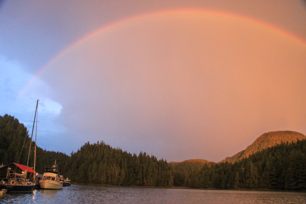
Rainbow over Nimmo Bay.
Enjoying the warm waters of Pendrell Sound.
Sailing out of Mackenzie Sound from Nimmo Bay.
Fantastic summary. I have loved following your adventures. 🙂
Thanks!
Thank you for posting this. It will help me plan for our trip to the same area next year.
Thanks, it has been great reading your adventures the past 3 months.