Sailing home is always bittersweet – it’s the end of a journey, a return to work, and the end of amazing days figuring out how to harness the wind to take us to beautiful anchorages. On the other hand, it’s a return to a bit more normalcy, routine, and the creature comforts of land life. Returning from a long cruise always stuns me with how comfortable modern life is, how few true problems we have in an average day, and how fortunate we are that that’s the case. It’s no wonder that some sailors never manage to leave the dock.
After Victoria, since we had less than a week left to our month long cruise, it was time to start heading back to Seattle.
[This post took place from July 26-30.]

Always amazing sunsets at Sidney Spit

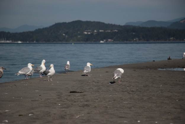
Sidney Spit had lots of birdlife in the morning. We saw at least a dozen blue herons and this group of seagulls was just a splinter group of a couple hundred seagulls.
Roche Harbor
Following a great stay at Sidney Spit, we sailed slowly across Haro Strait, and checked in through customs at Roche Harbor – no problems and it only took 10-15 minutes (but it sure was busy at the customs dock at 3pm on a summer Wednesday). We anchored on the southern side of the harbor, near a house that was being demolished. It perhaps wasn’t the best choice. The float planes take off right by there, with a deafening roar, and a lot of powerboats and 20-30 horsepower dinghies / superyacht tenders pass by only a boat length or so away, leaving a big wake.
Next time I would go back to our favorite spot from last year on the western side of the harbor in the 10-20 ft section. It’s a longer dinghy ride to shore though, so I’ve realized upgrading from our 3hp dinghy motor might be worth it – if we could go more than 4 kts, we could park further away from the traffic lanes, in better anchorages.
In the morning we hiked to the cemetery and mausoleum. The mausoleum is always interesting, and I like the historical info there – like how the broken column represents life’s broken link, symbolizing that a person’s work is never finished before they die. It’s also interesting how the mausoleum builder’s son cancelled completion of the structure ($20,000 for a brass dome, in 1914 dollars) because they were out of money (or he had better sense than sinking their fortune into a funeral pyre!).
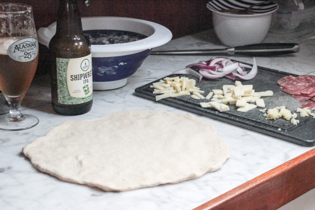
Pizza night on the boat
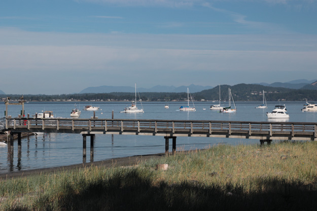
Friday Harbor
Thursday had wind – and the wind started in the morning – woohoo! Race Rocks was blowing 25-30, Haro Strait finally had the 15-20 they had forecast for yesterday, and that meant the San Juans had 15-20 SW-SE. First we had to motor past Spieden Island though – the ebb current flows fiercely there, and going to Friday Harbor from Roche often requires fighting current no matter what (it splits at the point, so before the point we have current against us, after it we have it with us). We hugged the shoreline in the shallows which reduced effects of the current. Once we got around the corner, the wind picked up from 6-8 to 15 on the nose and favorable current.
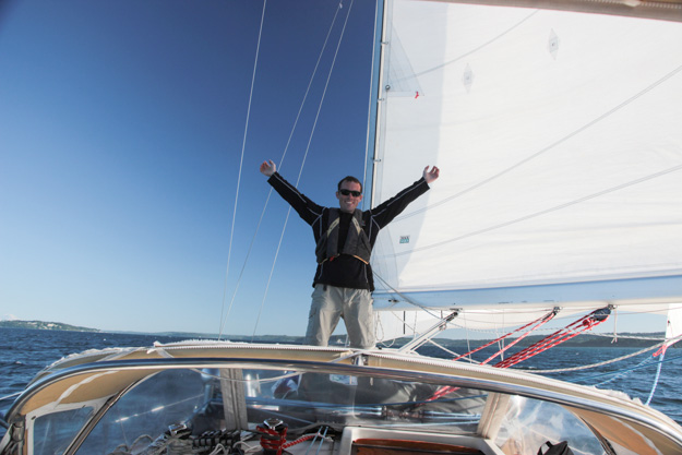
So we set sail upwind, with a reef in the main and a reef in the genoa. The wind was extremely gusty – we had gusts to 22 and two hundred feet later lulls to 6-8. But mostly it was 15 with gusts to 20. This made for very difficult helming conditions, a 15-25 degree angle of heel, and everything in the cabin getting tossed. I had a fun time, but scared my crew (my father-in-law).
I had never anchored in Friday Harbor before, and while dropping anchor, after being certain we weren’t over the charted underwater cables or the two marked wrecks, a nearby powerboater on a mooring ball yelled over that we were in a no anchoring zone. Apparently the entire square region between the two charted underwater cables is a cable area.
We moved outside the lines but afterwards I realized I had a misunderstanding about cable areas. Usually (in BC waters particularly it seems) a squiggly red line indicates the position of an underwater cable. In some US charts, like this one, they draw two squiggly red lines, which *don’t* indicate the position of underwater cables – and then write “cable area” in between those two lines. This means the entire square region is a cable area, and they haven’t bothered to chart exactly where those cables are.
This seems rather dumb to me – why have uncharted cables rather than mapping them so boaters can avoid them? It’s not very clear at all – the one sign on shore saying that the cable area extends to the east isn’t visible from some areas of the square area. So I wonder how likely it is that no boaters ever anchor in that region.
In answer to my question, the next day three powerboats promptly anchored in the cable area, and later moved (presumably when the mooring ball resident alerted them).
The problem is the cable area consumes a large area of the best anchorage space at Friday Harbor, and outside that there’s not a ton of room for anchoring. There are a lot of boats on permanent mooring balls, plus the ferry + float plane paths – and the depths are about 50 feet. I found the ferry wake is pretty minor though – because the ferry is moving at slow speeds by the time it pulls up to the ferry dock – so concerns about getting farther from the ferry were unnecessary.
Despite its challenges as an anchorage, the town of Friday Harbor is a great little town. On the walk back to the dinghy after happy hour, there was a small band in the little park between the marina and the ferry dock, putting on a free concert. They were playing what I believe was xylophones built out of PVC pipes but with beautiful wood slats above each pipe. There were six musicians with about 30 spectators, and they were perfectly in tune and in rhythm. It was the perfect accompaniment to a beautiful sunny San Juans day.

Dense fog in Friday Harbor anchorage in the morning – notice the ferry coming in behind that sailboat!
Mackaye Harbor
Friday evening we made a series of poor decisions which I don’t want to dwell on. Suffice it to say, motoring through Cattle Pass against full flood is a bad move. There are no back eddies in Cattle Pass (at least once you’re actually in the pass – there are good back eddies within Griffin Bay) and the tide rips are massive. There were giant swirling whirlpools, roiling white water, standing waves, and current pushing us towards rocks. We had thought we could beat the flood, but it was much stronger than expected.
Needless to say we won’t make that mistake again. After that we discovered Davis Bay is a poor anchorage because swell from the Strait rolls right into it. After anchoring there we moved to the NE of Charles Island, near Jones Bay and Mackaye Harbor, which was also very rolly but probably not as bad as Davis would’ve been.
Western Mackaye stayed very rolly all night because the Strait was windy all night (15 kts, according to the New Dungeness buoy). Next time I’d like to try the bay west of Jones Bay, or actually go into Mackaye Harbor.

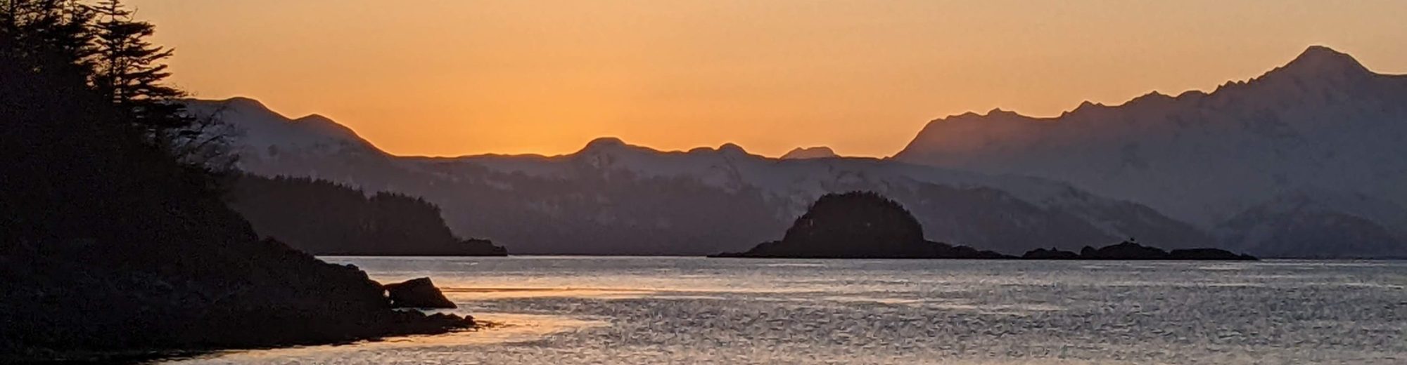
We did have a very beautiful sunset!
Crossing the Eastern Strait of Juan de Fuca
I think we’re starting to get a handle on the Strait’s wind patterns. It’s an extremely complex area, and we’re often frustrated by forecasts that seem to be wrong by a factor of 200-400%. Really it should be subdivided into perhaps four forecast regions: BC waters near Race Rocks + Victoria (the BC forecast basically covers this area), the northern section near the south end of San Juan Island and Cattle Pass, the middle section around Smith Island, and the Point Wilson turning circle.
The thing to realize about the BC forecast is they’re setting the forecast for Race Rocks, the windiest area of the entire forecast region. So their wind numbers are usually the most pessimistic (highest) possible – which you could say is the most conservative (safest) possible. But if you’re not planning to sail near Race Rocks, it can be very misleading because other areas may get only half the wind the forecast predicted.
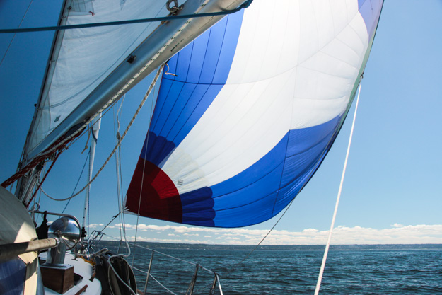
We had a small craft advisory (forecast to rise to a gale after 5pm) in the US NOAA forecast. In the northern section (by San Juan Island and Cattle Pass) we had 15-17 kts sailing with a reefed main+genoa, then it lightened to 10-12 so we unreefed the genoa, and then when it lightened to 8-10 around Smith Island we unreefed the main. Then it lightened to 4-6 around the Point Wilson turning circle, and we had our typical slow beam reaching in that area, not really going anywhere (due to being early for the flood). We had hoped the SCA or even the gale would carry across the strait to the turning circle so we could power through the current, but it didn’t.
A typical small craft advisory building to a gale on the eastern Strait: 4-6 kts of wind.
What I’m starting to realize, after 20+ crossings, none with ever more than 10 kts in the turning circle, is the Point Wilson turning circle is a massive wind hole. And NOAA is forecasting the wind for the worst area of the strait (the northern section) – speaking only of the typical summer inflow winds (a southerly would be a very different story). There is often wind from the north *after* the turning circle (in Admiralty Inlet, along Marrowstone Island) but no wind in the turning circle. The geography around Port Townsend must be really strange to be able to shape and redirect the wind that way. We’ve considered hugging the Whidbey Island side because the wind seems to be better over there, but if you’re early for the flood, that’s where the worst current would be, because the current switches to flood earlier on the Point Wilson side.
So while I’m sure Point Wilson has wind in a gale, it was frustrating to be looking forward to a great sail across the Strait, and end up a bit disappointed that the small craft advisory rising to gale turned out to be 4-6 kts. We’ve been getting a lot of days like this lately, with difficult to predict wind and wildly inaccurate forecasts.
Mats Mats Bay
We hadn’t been to Mats Mats in over a year, since our last summer cruise, and enjoyed it just as much the second time. It’s a circular completely protected lagoon with a 1/2 nm long narrow winding entrance. The depths are 5-12 ft at low tide (with a 3’ zero tide section in the entrance), so I would enter/exit on only at least a half tide. Once in, it was perfectly flat and quiet – making for a really nice night’s sleep after the prior night’s rolly, noisy Mackaye Harbor.
The next day the wind wasn’t up, but we needed to catch some of the flood to Point No Point to avoid fighting a strong ebb there, so we left about 11am. After Point No Point there was 7-8 kts N so we raised the spinnaker, but only made about 2 nm over the course of an hour, due to the current now being against us and the light wind. After an hour or so the wind died to 4-5, so we ended up doing about 4 hours of motoring to get back to Shilshole.
While it was sad the trip was over, it was good to be back. And even though liveaboards get to take their home with them wherever they go, Shilshole feels like home now.