Author Archives: Patrick

Summarizing 3 Months of Cruising (Part 1 of 2)

How do you describe three months of sailing? The truth is you can’t – no words can really sum up that amount of time in a short blog post. We had such an amazing time that to say it was life changing wouldn’t be much of an exaggeration.

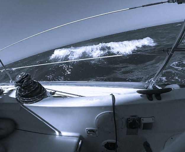
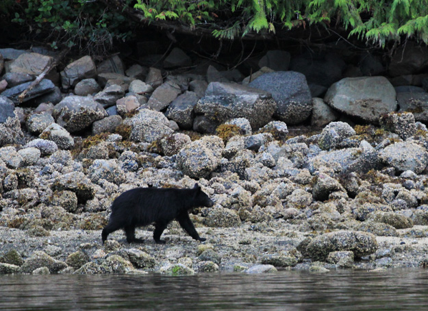
Some areas of remote BC were more beautiful than I could adequately put into words. We had surprise visits from humpback whales, seals and bears, reminding us we were not the only life out there. We encountered high winds and strong currents, situations that tested our boat’s strength, and our abilities as sailors.

My relationship with wind changed – I can’t look at water now without seeing wind – the ripples and the tidal interactions. A flag blowing on a hill side, or a gentle breeze on your arm. So many signals we used to read wind; wind started to become a kind of three dimensional map on the water, or a 6th dimension to our senses.

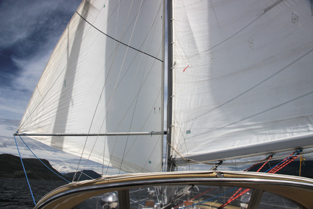
Wind was our motive force, our fuel – for this reason it reached a greater importance than ever before. We had a lot of mileage to cover, and most of it was wind powered.

All the stress of packing up our condo, selling or donating excess possessions, finishing last minute boat projects, and moving onto the boat had long since been forgotten – erased by the single minded focus you get while cruising. The only thing that mattered was keeping the boat moving and keeping us safe. Fun was a secondary goal, and as long as we were safe, it usually came easily.

img_2903

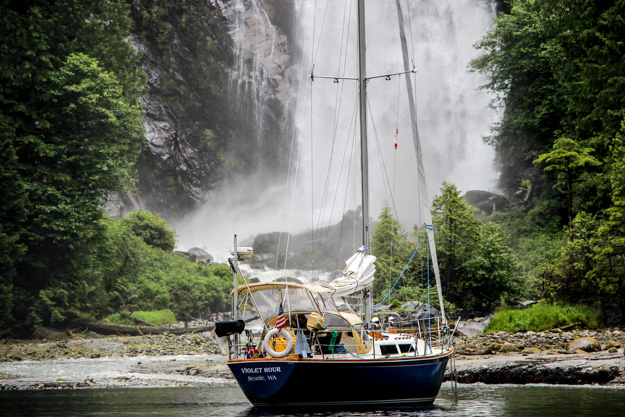
Anchored in front of the waterfall in Princess Louisa Inlet.

Route

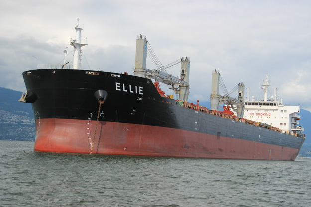
Our route took us over 1300 nautical miles, starting June 10 from Seattle at Elliot Bay Marina, and ending September 3 back in Seattle at Shilshole.

We first headed north to the San Juans, and spent a week or two there (meeting up with family), then traveled through the southern Gulf Islands before hopping over to the Sunshine Coast and visiting Princess Louisa Inlet.

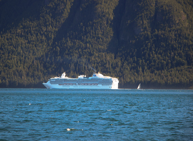
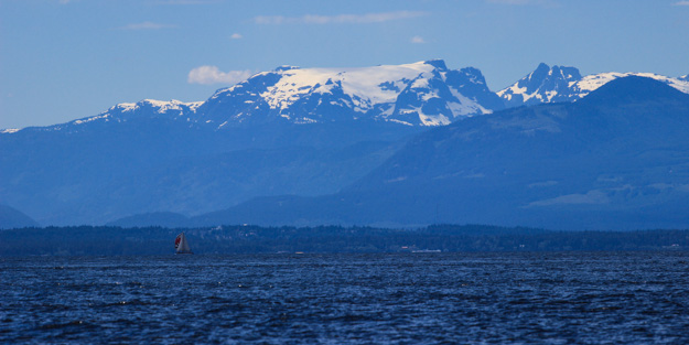
From there we headed north for some sunshine and warm water in Desolation Sound. Next we traveled through the back route to the Broughtons, bypassing most of Johnstone Strait but still dealing with the high currents of the tidal passes and some high winds once we reached Johnstone.

After reprovisioning at Port McNeil, we skipped past the Broughtons because we had southerly wind, and explored Queen Charlotte Strait. Miles Inlet was our furthest point north, almost to Cape Caution, at which point we headed back south and spent over a week in the Broughtons. The highlight of that area was sailing into MacKenzie Sound and visiting Nimmo Bay Resort.

We were a little tired of all the powerboats in the Broughtons and the mostly overcast, chilly days, so we headed south back through Johnstone Strait (all the way this time) and returned to Desolation Sound. Desolation Sound was hot and sunny by this time (late July), but also very crowded – we found a wonderful, more secluded spot in Pendrell Sound.

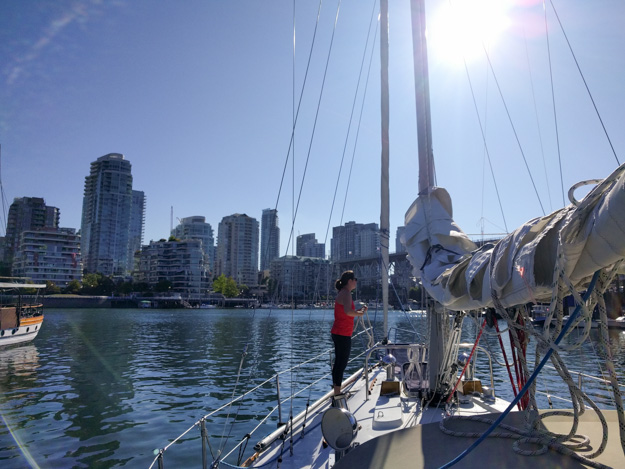
As we continued south, we visited Lasqueti Island, and went across the Strait of Georgia to Nanaimo and the northern Gulfs. Later we went across the Strait again to visit Vancouver for several days, and then crossed the Strait back westward (encountering high winds this time), to visit the Gulf Islands some more. We enjoyed the Gulfs, but before long it was time to move on – back to the U.S. through the San Juans.

We stopped in Port Townsend and then sailed south, past Seattle, to southern Puget Sound. Despite a complete lack of wind most of the time, we had fun visiting Natalie’s family in Olympia. From there we headed back to anchorages around Seattle and Bainbridge for a few nights, before it was time to truly end our trip and return to work.

img_2956

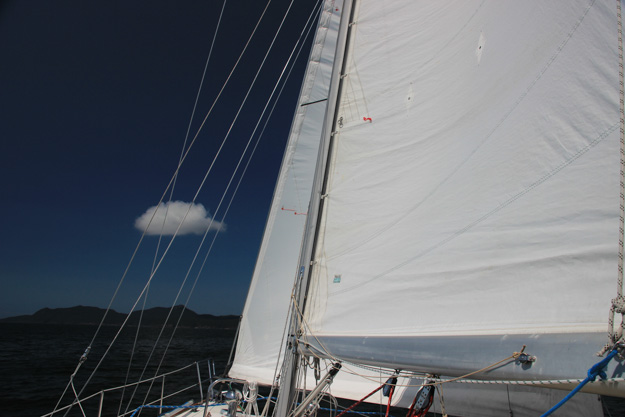
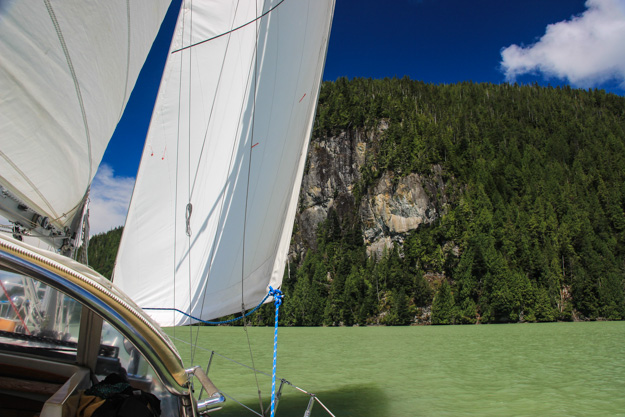
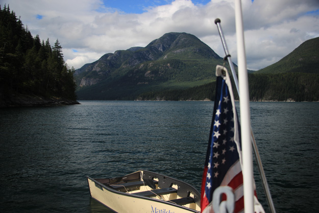
Looking west, on the way to Desolation Sound.

Continue reading

Windless in the South Sound, Except for the Midnight Gale!

A lot of cruising blogs seem to only have nice things to say about the places they visited. It gives the impression that everything is always sunshine and rainbows for them – which if true is great, but for us everything isn’t always sunshine and rainbows. We try not to be too cynical, but there are definitely a few places where if we had known what it was like, we probably wouldn’t have gone there. We’d rather know about the bad things along with the good, rather than be in the dark. Although everyone’s experience is different – what was bad for us might be great to someone else.

South Puget Sound – from the Tacoma Narrows to Olympia and adjacent inlets – is an area some guides and reports we’d read say is a wonderful cruising destination that is too often forgotten by the many boaters who primarily travel north (to the San Juans and BC). For us though, cruising means sailing, and in the South Sound we had the least sailing we’ve had all summer.

IMG_3588

No Wind Makes For Sad Sailors

We really enjoyed visiting the city of Olympia, but it would’ve been much easier and quicker to drive there. We did close to 30 miles of motoring each way, and south of Gig Harbor there was basically no wind for four out of the five days we were there. Completely flat water without a ripple in sight, and less than 2 knots registering on the wind meter – morning, afternoon, and evening. One day we got 4-5 knots for about 20 minutes, and raised sails, but it quickly died back to zero.

August often has little wind in Puget Sound – so perhaps the South Sound is a good destination only in the shoulder seasons (fall and spring). But even though Puget Sound was getting 10 knots, according to the West Point NOAA station and Washington State ferry readings, we were getting none. And as soon as we left the South Sound and got to Gig Harbor, we had wind again.

IMG_3593

Passing under the Tacoma Narrows bridge

Continue reading

Rough Waves and Humpbacks Breaching in the Strait Of Georgia

As I sat in my inner tube behind Violet Hour anchored in Selby Cove, beer in hand and sunny blue skies overhead, I reflected on how quickly conditions can change while cruising. Just yesterday we were in the Strait of Georgia with 4 foot waves and 20 knots of wind, the Strait a raging cauldron of turbulent waves and wind. The boat was rocking enough that even using the head was a struggle. When we weren’t uttering unprintable words about the state of the waves, the kindest word we had for them was “manageable.” As in, “these waves are pretty awful, but manageable.” Then moments after passing through Porlier Pass into the Gulf Islands, a dramatic change occurred – the water went completely flat and the wind died to an easy 6-10 knots. The protection afforded by the Gulf Islands is truly impressive.

GoProStill-WaveInStraitGeorgia

Three days prior, on the way to Vancouver, we had crossed the Strait with completely flat water and 3-5 knots of wind. We continue to be impressed by how dramatically different the Strait of Georgia can be from one day to the next.

Burrard Inlet

We left Vancouver at 9:30am, early, because according to the buoy reports, the wind was already up in the Strait of Georgia – blowing a steady 20 knots since midnight. We didn’t feel any of it in Vancouver though, the calm, flat, windless surroundings lulling us into thinking we had a relatively easy day ahead of us.

As soon as we got out into Burrard Inlet, the wind picked up to 10 knots on the nose, so we set sail. As we sailed upwind, we tacked close to giant container ships that are often anchored in the bay. I said to Natalie, “this is the closest I ever want to be to the bow of a tanker” (at least not when it’s moving).

Before long the waves in the inlet grew to 3-4’ steep, close spaced waves. They were manageable, but not fun – we considered turning back. As we beat upwind into the steep waves, they slowed our boat’s progress to only 3 knots at times, even though we had full sails up in 15 knots, which normally means 6 knots of boat speed. Carefully focusing on hitting each wave right allowed us to keep a speed closer to 5 most of the time.

Continue reading

Cruising into Vancouver – A Homecoming of Sorts

Arriving in Vancouver was filled with confusing emotions and memories – coming into a big city after months away from cities was overwhelming. There were so many people! And towering apartment buildings holding unimaginable numbers of people – unimaginable because they hold more people than we’ve seen all summer.

Our first time sailing into Vancouver also brought forward some nostalgia since it’s where we bought our boat a year and a half ago. Those memories feel so long ago, yet it was only February of 2015 that we were arriving to Granville Island for a weekend on the boat to prep her for the trip to the US. It was freezing cold and we had to make a run to Canadian Tire to get a heater. We knew so much less then about how to maintain / repair boats – we didn’t even have a square head screwdriver, necessary for the hundreds of square head screws on our boat. It felt like a bit of a homecoming finally sailing our boat back to Vancouver.

It was also the 2 month mark of our 3 month cruise, and we were starting to miss some aspects of normal life – basic things like talking to other people, restaurants, and biking. After a lot of time away from civilization, we were ready for some time in a city.

IMG_20160811_091943

IMG_3456

Getting to Vancouver involves driving past plenty of anchored tankers.

Continue reading

Lasqueti Island – A Gunkholer’s Paradise

On our return trip through the Sunshine Coast, we made a stop at Lasqueti, to “Graveyard Bay” on the southwest side. Although Graveyard Bay sounded ominous, it was the perfect little anchorage. There’s tons of wild life around Lasqueti – in our little cove we saw numerous birds, seals, a couple blue herons, and three sheep grazing on the hillside. It’s a quiet, peaceful place, with few other boats – most other boats pass up Lasqueti on their way to Desolation Sound, probably because it requires detouring a bit out into the Strait of Georgia, rather than sticking to the more common route up Malaspina Strait.

We met up with another sailor we know from the Seattle area – Alan of S/V Kingfisher. Our paths happened to be crossing, and we had a great time having dinner on our boat (with ribs, salad, and plenty of beer and wine) and then breakfast on his the next morning.

IMG_3436

Sailing upwind to Lasqueti.

IMG_3439

We regretted not spending a second night at Lasqueti to try out a new anchorage, but the wind forecast was perfect for sailing to Nanaimo, our next destination. But first I need to jump back a bit – there were several other stops on our Sunshine Coast round 2 before we made it to Lasqueti.

Continue reading

Desolation Sound Round 2: Swimming in Pendrell Sound

After the Broughtons, returning to Desolation Sound in late July was a bit of a shock – there were so many boats! And it was hot – really, really hot. In the Broughtons we were wearing long underwear and fleeces much of the time, but now we had to pull out our bathing suits. Adjusting to the heat was tough the first few days – it made us dead tired, and we doubled the water we drank. The number of boats was an adjustment too – some anchorages (like Squirrel Cove) were so full, it felt like we were on Lake Washington in Bellevue.

IMG_3377

Beautiful views while anchored in Pendrell Sound.

Inner Tubing in Pendrell Sound

Pendrell Sound turned out to be everything we could’ve possibly hoped for, and made our week. We had heard good things about it from other cruisers, but our guidebooks didn’t have a lot of detail on it, and we weren’t sure about a few parts. Would the depth of the anchorage make it difficult to find a spot (especially given how crowded other anchorages around here have been)?  Pendrell Sound is somewhat like Princess Louisa – thousands of feet deep in the middle, and towering mountains on the sides. There are no bays or protected anchorages with large areas of shallow depth. I also worried would strong winds funnel down the channel making the anchorage uncomfortable and unprotected?

These worries turned out to be unfounded – the weather was perfect (sunny, hot, and no wind above 8 kts), and we had no trouble finding a very nice nook to anchor in with a stern line run to shore.

We anchored in one of the nooks on the west side, about 3/4 of the way into the sound (not at the head, where the majority of boats seemed to go – we’re not sure why, perhaps the view is a little better there). We switched our anchor to our 300 foot rope rode (with 25’ of chain) instead of our 150’ chain, since the rope is better for deep anchorages. We ended up dropping in 60’ and only putting out 120’ of rode. We then pulled the boat back with the stern tie, getting to within about 50’ of shore. At low tide the depth at our stern was 21’.

We met another boater who spends a week in Pendrell Sound every year. We spent two days, but could easily see ourselves coming back next year.

IMG_3373

Continue reading

Southbound in Johnstone Strait

Our trip south back to Desolation Sound was quicker and less difficult than our trip north through the tidal passes. This was to be expected since going south on this route you usually have the wind at your back. For this reason we took Johnstone Strait the whole way, rather than dealing with timing the rapids at four tidal passes on the back route. We still had to time currents at Race Passage / Current Passage, but were fortunate the wind wasn’t even blowing the day we went through there.

That’s not to say it was without challenge though. Our most harrowing, dangerous moment came as we were racing downwind in Johnstone Strait pulling into our anchorage for the night (Mary Island, off of Sunderland Channel and Fanny Island). The winds had picked up to 25 gusting to 28, and the seas had risen to a 3 foot chop as the current rushed with us at peak flood. We still had the full main up, with no genoa – we should’ve reefed the main, but the wind had risen quickly and we figured we could ride it out since we were 30 minutes from the anchorage.

I had hoped the anchorage would provide some protection from the wind so we could do the mainsail takedown in there, but the anchorage was small and the wind was gusting into it too. We soared into the tiny bay at 6-7 knots and then turned into the wind, cranking the engine up to counter the 25 knot winds and surging waves. There were rocks to our starboard, rocks to port, and an island behind us. We did a fast drop, and got the main down okay – everything was fine after that, but it was one of those moments you remember forever.

IMG_3319

Sailing wing on wing in Johnstone Strait in about 15 knots

Continue reading

Cruising the Broughtons

Green. Green and more green; and sometimes blue and white, when the sun emerges revealing blue sky and fluffy white clouds. But mostly what we see in the Broughtons is green – in the dense trees surrounding us, and in the water too – taking on a deep emerald hue caused by the reflection of so many trees.

There must be something about the color green that connects to the human soul – a color meaning peace, tranquility. Here in the Broughtons the blue and white aren’t always present, but the green always is. It’s hard not to feel like we’ve found a special place.

The Broughtons were our last major goal for this summer’s trip. We’ll spend a few weeks here, and then can turn around and leisurely make our way back to Seattle with the remaining month and a half (spending more time in Desolation Sound – which we rushed through a bit on the way up – and visiting Vancouver and Nanaimo).

IMG_3237

IMG_3270

Our 2nd black bear spotting, in Shoal Harbor. I had to dinghy closer to get a decent picture. This guy seemed a bit small to me – maybe an adolescent?


Continue reading

Exploring Queen Charlotte Strait

After reprovisioning in Port McNeil, we had mild southerlies predicted for a few days, so we decided to use those winds to go further north – past the Broughtons and towards Cape Caution and Port Hardy. We went to Blunden Harbor for two nights, Miles Inlet for two nights, and then back across the strait to Beaver Bay which is around the corner from Port Hardy. Then we crossed the strait again to Wells Passage and the Broughtons.

We’re over a month into our 3-month trip now, and realizing how long a time that really is. So much has happened in a month that sometimes it’s hard to believe we have two more of those. On a 2 week or 4 week trip it’s possible to ignore some hardships and just deal with it. When it’s 3 months, you can’t ignore the little hardships of cruising as much – they’re part of your everyday life, so you need to find a sustainable pace. And not every day has good weather – we’ve been finding a lot of almost Alaska-like weather for July – chilly, overcast, and off-and-on rainy.

One thing we’ve been surprised with is how many more powerboats than sailboats there are up here. There are at least twice as many powerboats as sailboats in most anchorages, but in some places it’s closer to 10 to 1 (in our current anchorage we have 9 powerboats and we’re the only sailboat). It makes sense though – the Broughtons and beyond are a long trip from the Northwest boating centers, and powerboats can make the trip quicker than sailboats – which gives them broader range. Since what most boaters are shortest on is time, that means more powerboats reach the more remote areas.

IMG_3144

Exploring Miles Inlet by dinghy

We met a sailor single-handing a Contessa 26 (sailboat) in Shoal Bay, and have been running into him often since then – at Port McNeil, at Blunden Harbor, and at Cypress Harbor. Hannes is really serious about sailing – he uses less fuel than probably your average suburbanite’s lawn mower, and will patiently spend hours drifting in a 2 knot wind. He stores his bananas in the bilge because he has no refrigeration. It’s one of the things I love about cruising – we all have different ways of getting here, but everyone gets to enjoy the same beautiful views. The water is a great equalizer.

Continue reading

Desolation Sound to the Broughtons: Route Planning and Sailing Challenges

In the last week (July 3-8) we’ve made it from Desolation Sound to the Broughtons, passing through the last major hurdle of our trip – four tidal passes (where rapids can form), parts of the notorious Johnstone Strait with its high winds and challenging tide rips, and many kinds of weather including northerlies, southerlies, and rain. In a way it felt like we’d run the gauntlet, in terms of encountering a new sailing challenge or weather condition every day.

We were never bored, and if we had done this with less experience (ie, a year ago), we probably would have been often scared. But thanks to more experience and preparation, things overall went really well.

This post will be mainly about our route – and fairly technical (more of interest to other sailors planning to do this passage). Our route is certainly not the only one possible and many choose to do it differently, but I figured the reasoning behind our routing might be interesting. In researching beforehand I hadn’t been able to find many accounts of people’s actual routing choices in cruising guidebooks or blogs.

IMG_3075

A view from Port Neville. Yes there is a sailboat (flying genoa only) behind that cruise ship. Really puts into perspective how big the cruise ships are.

IMG_3063

Celebrating the Fourth of July in Forward Harbor

Tidal Currents

Understanding tide and currents is important anywhere in BC or the Puget Sound, but going through the rapids on the back route to the Broughtons, or through Johnston Strait, it becomes much more important. This is still one area we struggle with sometimes. The currents often seem to be doing different things than what the tide tables and current stations say they should be doing. The tidal movements in this area are extremely complex – in Johnston Strait you can have surface ebbs while a flood is going on, or it could be flooding on one side of the strait while it’s ebbing on the other side. And if you miss slack at a rapids by just 30 minutes it could already be moving at 2 knots; miss it by an hour and it could be moving at 5 knots.

Here’s an example of a typical route planning question we have to determine the answer to: If you need to sail 10 miles north in Johnston Strait with a 15-25 kt wind blowing from the north, would you go when the current is flowing north (ebb) or when it’s flowing south (flood)?  I thought the right answer was the ebb. While current opposing wind (current going north, wind going south) is well known to be a recipe for short waves and tide rips, surely that would be better than bucking a 3-5 knot opposing current?  Going against current could slow us to a crawl. Since the typical 38-foot sailboat can only do 6 knots into a 20 knot headwind (motoring; and less when sailing, considering VMG to the windward destination), a 5 knot opposing current can slow you down to 1 knot – it would take 10 hours to do 10 nm.

After experiences in Johnstone Strait on an ebb with a northerly, I’m not so sure. The current opposing wind created short, sharp waves, especially in the tide rip areas, and these waves slowed us down by a knot anyway, in addition to making things really uncomfortable. And although the current predictions said there should be a 3 knot current, we only experienced about 1 knot of current. This was a lesson we took away – that current against wind trumps going with the current. At least in Johnstone Strait.

Continue reading