Author Archives: Patrick

Sunshine and Inner-Tubing in Desolation Sound

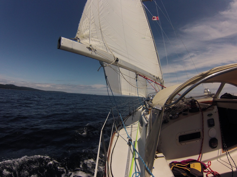
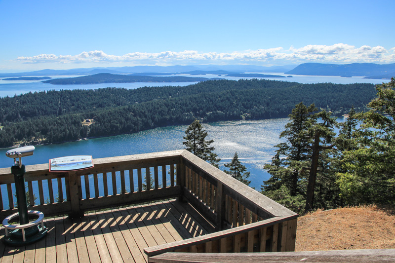
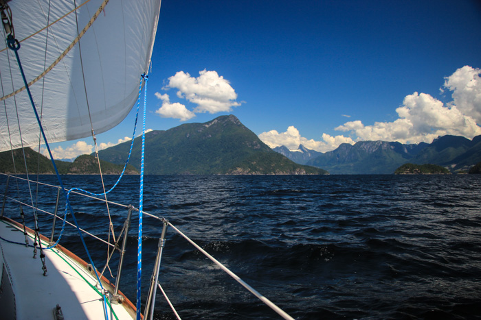
This Monday (June 27th) we sailed into Desolation Sound with the sails wing-on-wing, a gentle breeze from the southwest pushing us towards Sarah Point. There couldn’t have been a more picturesque way to arrive in Desolation Sound, with snow capped mountains unfolding before us. Reaching Desolation Sound was the first major goal of our summer cruising plans. So far this area is proving why it is so deserving of its reputation and popularity.

IMG_2999

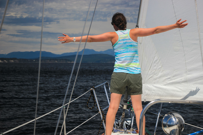
We’ve had surprisingly good sailing, this whole trip in fact. Other than the trip up Jervis Inlet to go to Princess Louisa, we’ve had fewer than 2 days (out of about 20 days) with no sailable wind. It’s funny because the reason I was in favor of doing the west coast of Vancouver Island last year was primarily because I had heard the inside route (to Desolation Sound) lacked wind and not much sailing could be done. But this year we’ve sailed far more than we did last year. We’re sailing so much that we’ve barely used 30 gallons of diesel, since leaving Seattle three weeks ago. Perhaps we just know the boat better and have worked out the right rhythm – short hop trips and flexible timing based on the weather – but I’m kind of  surprised our formula for being sailing cruisers is actually working.

IMG_2963

Continue reading

Mosquito Hunting On The Sunshine Coast and Desolation Sound

“There’s a mosquito on your head!” said Natalie. “Where?” I replied.

“On your forehead.”

“Oh, really?”

“Yeah, it’s going to bite you.”

We’ve found a new game as we approach Desolation Sound – mosquito hunting. On a good night (bad night?) my kill count approaches a dozen. The two anchorages we’ve been in – St Vincent’s Bay in Hotham Sound near Jervis inlet and the Copeland Islands (north of Lund) – both had an army of hungry mosquitoes waiting for us as soon as we arrived.

Since we don’t have mosquitoes in Seattle, I had forgotten how annoying they can be. On a boat, there’s no where to run; you can hide, but they will find you. The mosquitoes sneak in through open hatches as soon as you arrive. “Dinner!” they must be thinking. We then closed the hatches, but that makes the boat extremely hot. We have bug spray, a bug net to drape over a hatch, and a citronella candle. These help only a little bit.

IMG_3028

Continue reading

Our Trip to Princess Louisa Inlet

I wasn’t going to write about Princess Louisa because the saying is that everything that could be written about it, already has been. Perhaps that is true, but I’m not so sure. Primarily this will be a pictorial post, so skip to the end if you just want the photos.

IMG_2900

It might sound like blasphemy, but for us Princess Louisa wasn’t the heaven-like wonder some had described it as. Maybe it was because we had low cloud cover (~1000 foot level) and never saw the full experience. But we didn’t think Princess Louisa was fundamentally different from many of the other cruising destinations we visit in BC. There are a ton of off-the-beaten track anchorages with amazing scenery and a special connection with nature. This is what cruising is all about. Princess Louisa was simply another version of that – perhaps scaled up by a degree.

Continue reading

Crossing the Strait of Georgia in a Southerly

As the waves settled out a bit from their previous roar, we said (for the fourth time), “Things are looking better now.” No sooner had we said that than another series of rollers came along. The boat rolled from toerail to toerail. We could hear the wave coming by the roar of the breaker. Breaking waves don’t normally happen outside the ocean, but minor ones do happen when you have 3-4 foot waves at 3 seconds.

Each time bigger waves hit our stern quarter, the wave crest would push the boat’s stern, causing us to start to round up – in 20 knot winds. So I have to anticipate every wave and react quickly and forcefully with steering. As a wave lifts us up, the boat surfs and we drive down it. We’re doing 7 knots at times, under a single reefed main and no foresail.

We were in the Strait of Georgia – a seemingly routine waterway east of Nanaimo – heading from Porlier Pass in the Gulf Islands to Pender Harbor, on Tuesday. We knew we’d have a flood current with a southerly wind – two good things, since you want wind following current, and the wind here is usually not southerly, but southerly allows us to sail downwind which is much easier than upwind in choppy waves. We expected a downwind sleigh ride. But it wasn’t working out as well as hoped – high wind is manageable, but the short steep swell was an issue.

DCIM100GOPRO

Easy sailing – We began the crossing with 10 kts, on a broad reach

Continue reading

Hiking Mt Norman Leads Us To A Panoramic View of the Gulf Islands

As we huffed and puffed up the steep climb, we said to ourselves, “This had better be worth it!”  It was only a 1.8 mile (2.9 km) hike – 3.6 miles roundtrip –  but with 800+ feet (266m) elevation gain, and we hadn’t done any real hikes in a while. It was hot out, and we hadn’t brought enough water – from the San Juans we’d grown used to island hikes being short and easy.

Mt Norman is on South Pender Island, our first stop in Canada after crossing the border from Friday Harbor on Sunday. Our Nexus passes had made customs checkin a breeze – we called in, got our clearance number, and did a touch-and-go on the customs dock (if there are no customs agents, with a Nexus checkin you don’t have to stay).

As we rounded the last corner of the hike, we came to a viewing platform with a 180 degree view of the Gulf Islands stretching out before us. It was a beautiful day, and all I could think was wow, the hike was definitely worth it! The photos don’t really do it justice because unfortunately I can’t stitch together my panoramic photos since I forgot to download a panorama program before leaving Seattle, and don’t have Internet in the South Pender anchorage.

IMG_2838

       IMG_2851

Continue reading

Tricky Anchoring at Patos Island, San Juans

This week we’ve felt like we were running before the storm – the weather forecasts have often been pretty pessimistic. One forecast was for “rain, 15-25 knot winds, possible thunderstorms, and a chance of hail.” But somehow we’ve managed to do short sails between islands in the gaps between bad weather, and the weather also hasn’t been as bad as forecast (no hail or thunderstorms).

After Sucia, we spent a night at Patos Island and then moved on to Prevost Harbor at Stuart. More on those below.

IMG_2795

The postcard perfect lighthouse on Patos Island

Continue reading

Matts Matts Bay and Watmough Bay

In the last three days we’ve gone from Seattle to Matts Matts bay, to Watmough Bay in the San Juans, and then on to Sucia Island. We had forgotten how amazingly beautiful the San Juans are – they really are a Washington state treasure. Everywhere we look are scenic mountain ranges, evergreen covered islands, blue skies (sometimes), and wild life. Our journey is only just beginning, but it already feels like we’re a world away.

From a sailing perspective the most amazing part is we’ve sailed most of the way and haven’t had to sail upwind even once – when there has been wind, it’s been at our backs. We’ve been riding a wave of southerlies north. That hasn’t meant it’s been easy – there have been a few challenging times as we’re getting back into the routine of cruising.

IMG_2777

Looking out on Fossil Bay on Sucia Island

Continue reading

Casting Off The Lines

Today we cast off our dock lines and leave Seattle for three months. This day is something we’ve looked forward to for a long time. The trip will be a true adventure. Maybe more adventure than we’d like. Last year we found the adventure we dreamed of was not the adventure we seek.

We don’t know yet what we’ll find. But if we knew every challenge we’d face, it wouldn’t be an adventure.

IMG_1942

It would be far easier not to go. It would be more comfortable and less scary to sit on our couch drinking beer and watching Game of Thrones on Sunday night. Our jobs pay the bills, and it’s difficult to give that up, if only temporarily. It would be far more comfortable sitting in an air conditioned office each workday rather than grinding winches, battling wave spray sailing upwind, and repairing a diesel engine. But that isn’t the life we want to live all the time.

Continue reading

Summer Plans: Seattle to Broughtons and Back

In 2 weeks we take off on our 3 months of cruising. I promised some more details on where we’re going. One thing we’ve been realizing in telling our friends and family about our summer destinations is most people have never heard of these places and have no idea where they are or what they’re like. So in this itinerary I’m including some background info on the locations.

The itinerary is not exact – when cruising we try not to sail to a schedule. All the dates are +/- 2-3 days, and the variance gets higher the later in the trip we get (+/- 5-7 days) – we also might add or eliminate destinations especially in the later half. If any fellow cruisers are going to be in these locations on nearby dates, send us an email (use the Contact link at the top) so we can try to meet up in an anchorage.

IMG_2053

Continue reading

A Cruise to Gig Harbor

At last freed from the clutches of the boatyard, this was our first weekend cruise in a month or two. And we were lucky to have fantastic conditions!

Friday evening we took off early because I knew the sunny skies with 15-20 knot north wind couldn’t be passed up. We wanted to head south, so this wind was perfect to give our sail from Shilshole a jump start. When we left the marina around 5pm, the forecasted 15 knots had picked up to 20-22, so instead of raising a double reefed main and genoa we decided to simply unfurl the full 135% genoa. This worked great, keeping our boat speed around 6 knots. The C&C Landfall 38’s masthead rig likes a big foresail.

A beautiful sunset from our anchorage at Blake Island the first night

A beautiful sunset from our anchorage at Blake Island the first night

Continue reading