We just finished our first full circumnavigation of Vancouver Island. This is a big milestone for many sailors, although for several years we shied away from it – partly due to misplaced fears, and partly because we don’t do things just to check them off a list. We’re trying to maximize the fun ratio in cruising, and we weren’t sure the west coast provides the best bang for the buck.
To sum up the whole trip would be very difficult – we spent over a month going north on the inside, and 6 weeks going down the west coast. I’m going to recap the west coast part though because that’s the portion that was the most unknown to us (and to most PNW boaters).
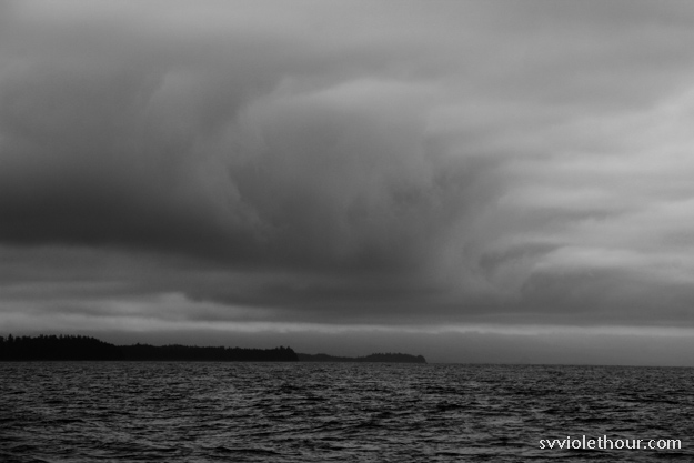
As they say in cruising, the highs were very high and the lows very low. Overall though we didn’t have any terribly difficult parts – our main challenge was dealing with the weather, which turned out to be highly unusual this year. It was the rainiest, chilliest, darkest, most humid July we can ever recall.
And that’s not just our perception – Seattle meteorologist Cliff Mass apparently thought so too. We had southerly wind the majority of the time, which meant our voyage was mostly upwind, not a downwind sleigh ride like everyone thinks it is. More on that later.
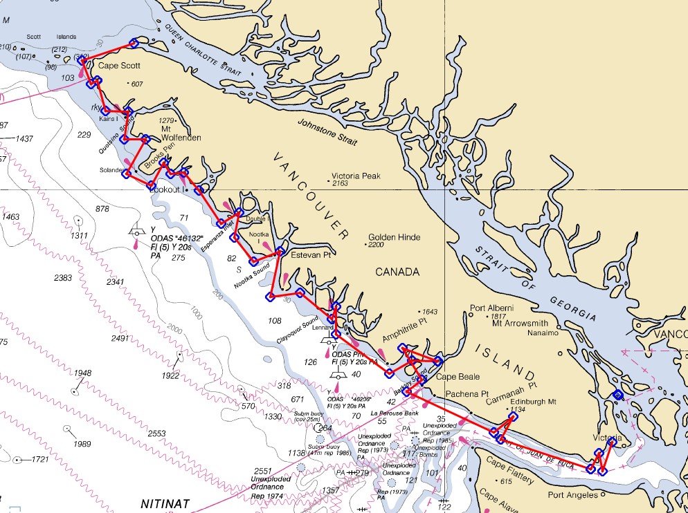
Route
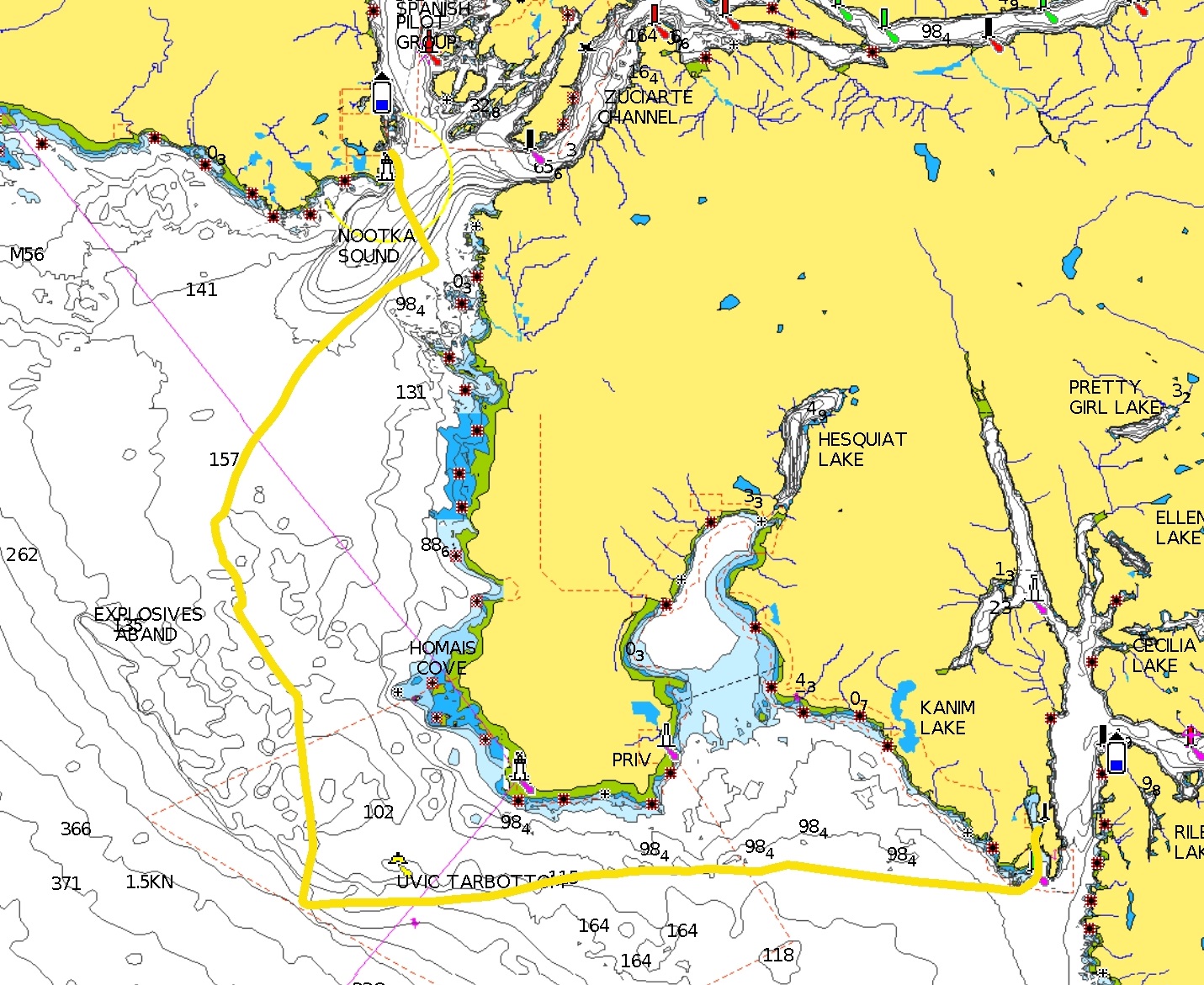
We started out from Port Hardy, sailing/motoring up Goletas Channel to Bull Harbor. From there we crossed the Nahwitti bar and sailed around Cape Scott in excellent conditions. We spent some time in Quatsino Sound, spotting sea otters and refueling at Winter Harbor, and then sailed around the Brooks Peninsula, having one of our best sails on the headland that has the scariest reputation.
Next we spent 5-6 days in Kyoquot Sound, slowing down to explore the beautiful anchorages and also because there was no wind. We motored to Esperanza Inlet on a flat, calm ocean, and then the forecast changed to a low pressure front bringing 5 days of southeasterly wind! We wondered if there is ever northwest wind on the west coast, and where summer was.
In the second half of July, summer showed up and we sailed from Nootka Sound to Clayoquot and then Barkley Sound, spending 2 weeks in Barkley Sound. We had sunny days and easy sailing inside Barkley Sound, although the rain wasn’t completely over (we got drenched for 24 hours on August 1). A few days later we headed into the Strait of Juan de Fuca via Port Renfrew and Becher Bay, bringing the west coast portion of our voyage to an end.
West Coast Van Isle: Two Distinct Halves
One thing we learned on this trip is the west coast is really two distinct parts, with significant differences:
Part A) Northwest coast, including Quatsino and Kyoquot Sounds, Esperanza inlet, and Nootka Sound. This part, which was new to us (except for Nootka) is very remote, with scarce access to fresh groceries. There are ways to get food, but all of them are more difficult than elsewhere, with a smaller selection as well as less fresh (transported a long way). Marine services are basic, if even available. As example, in two and a half weeks here we were on dock twice and neither had shore power. Our solar was essential. Marine supplies are scarce as well so it’s important to be self sufficient.
Other than Winter Harbor, there are no convenient locations to get diesel fuel (the other locations require motoring inland at least 20 nm round-trip – to us it doesn’t make sense to burn diesel just to get diesel). So we planned on making our fuel from Winter Harbor last until Tofino. Another big resource that is absent here is cellular service – other than a small cellular zone around Quatsino lighthouse, there’s no service until Clayoquot Sound.
Part B) Clayoquot and Barkley Sounds. These two, the southernmost, are easier cruising for a couple reasons. One is they both have access to all the resources a cruising boat needs to regularly replenish: food, water, and fuel. Another reason is they have an abundance of convenient, well protected anchorages, closely spaced. There are more cruising boats here than the northwest coast, although still far fewer than most of the Inside Passage.
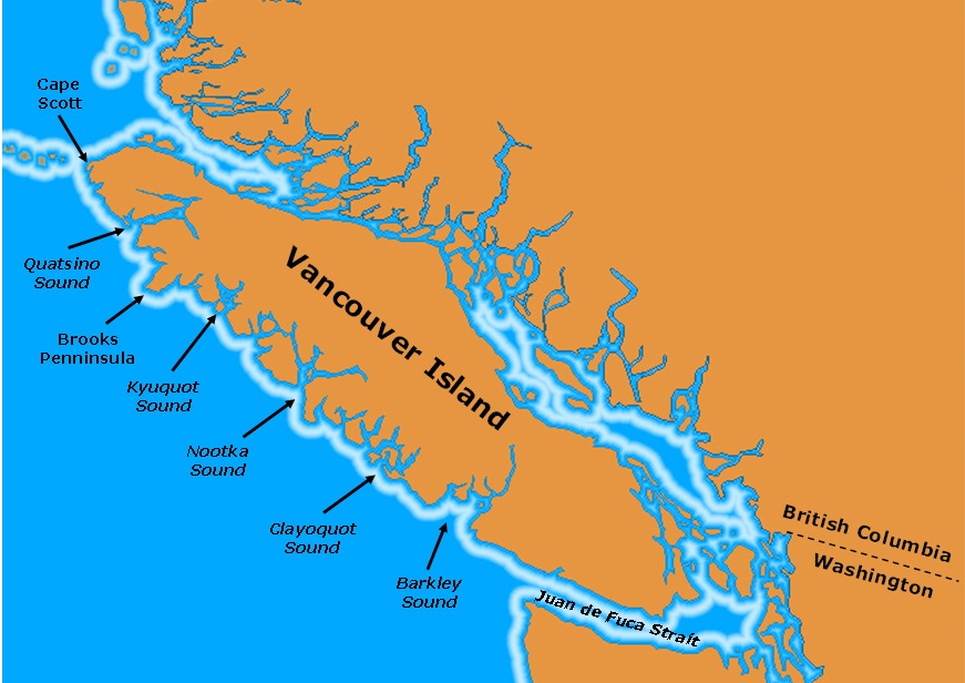
Image credit: MV Dirona
The remoteness of Part A was something we hadn’t anticipated very well. We spent two and a half weeks there but that was stretching the limits of our “off-the-grid” capabilities. Spending more time there would be hard. Groceries (mainly stocked in Port Hardy) were running low and going 2 weeks without Internet is surprisingly hard (yes, we did have Internet briefly in two places during that time). Going that long without Internet means making sure your friends+family know you’re not dead, your financial life is in order (autopay for bills is working, credit card fraud resolved – one of my card #’s got stolen somehow), etc.
The difficulty of reprovisioning means it can be difficult to explore each of the four regions of part A very deeply. If we spent a week in each region, we’d be out for 4 weeks and would run out of food and possibly water. So a good strategy I think is to pick one sound to explore in depth (this was outer Kyoquot for us) and then just spend a few days in the outer anchorages of the other ones, so you can easily get out to the ocean when a favorable forecast arrives.
Stats
These stats measure from Bull Harbor (Nahwitti Bar) to Victoria. Our west coast voyage really felt like it started from Port Hardy (slightly further south), because that’s typically the last point of civilization for cruisers rounding counter-clockwise. Port Hardy was the last place we had cell phone reception until Tofino (except briefly at Quatsino Lighthouse), the last port with well stocked groceries, and the last place with major marine services.
- Duration: June 25 – August 7, Bull Harbor/ Nahwitti Bar to Victoria
- Distance as the motorboat travels: ~520 nautical miles
- Distance as sailed/motored: ~720 nautical miles (estimate)
- % of distance sailed: 60-70%
- Engine hours: 44 (approx 22 gallons diesel used)
- # Nights at anchor: 40 (27 anchorages)
- # Nights on dock: 5 (2 public docks, 1 marina)
- Anchorages with mosquitoes: almost all of them
- Sea otters spotted: 50+
- Whales: 10-20
Weather
The weather was by far the biggest challenge of our west coast voyage. July had undoubtedly the worst summer weather I can ever recall. It was so-so in Seattle and interior cities, but the exposed west coast receives it worse – it takes the brunt of southeasterly weather systems moving in. It was quite strange to be reminiscing on the hot, sunny days of May during a chilly, rainy July.
Some of this is normal (the climate on the west coast is different – temperatures were usually 10-15 degrees F colder than Vancouver, even when we were at the same latitude), and some of it was exceptional, due to this year’s unusual July weather systems.
July 18 was I’d say the first day of summer, because it’s when everything changed – we had classic northwest wind with sunny skies, and two or more consecutive days without rain. Still, it was surprising how regularly the southeasterlies were still getting through. As late as August 1, when we had a big southeasterly gale hit south Van Isle bringing a full day of heavy rain. We had big southeasterlies July 9-11, July 17, and August 1. These southeasterlies often felt much like the ones we normally get in November. The days were as dark as winter, and we got no solar output – and a pretty wet boat.

Southeasterly that hit Van Isle on August 1st, bringing buckets worth of rain (our dinghy took on 10+ gallons!)
Wind
They say counterclockwise is the “right” way around Vancouver Island, to take advantage of prevailing northwesterly winds on the west coast, but I think this oft-repeated notion does more disservice than it does good. This year we’ve had south wind more often than north wind, and predominately southwest swell – so you could probably go either way around equally as easily.
We were upwind about 70% of the time and downwind 30%. If I had to estimate the wind strength distribution, by percent of time, I’d say*:
- 0-9 kts: 45%
- 10-15 kts: 35%
- 16-20 kts: 19%
- 20+: 1% (22 kts for about 30 minutes I think?)
* I excluded the Strait of Juan de Fuca from these estimates because I wouldn’t consider it part of the west coast of Vancouver Island. But a good downwind sail is nearly assured there – we had a fun and fast day 2 in 15-30 knots!
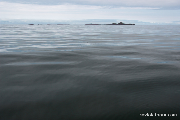
People often think the ocean is easier to sail in, perhaps because they think the wind is more consistent there. But in our experience that isn’t the case. There are many light and variable days on the west coast of Van Isle. There may be wind 20 miles offshore, but that doesn’t help when you’re trying to do a 30 mile coastal passage.
We knew if we’d stayed to the Inside Passage we’d actually get in more sailing. Counter-intuitively, the Inside Passage is more sailable because it has wind funneling effects (Q Strait, Johnstone and Str Georgia) and wind created by diurnal warming. It would be rare indeed to have less than 5 knots of wind in Johnstone Strait for 3 days straight.
Since in fact we did go back on the inside last year, I can compare our engine hours from those logs to this year. From Cape Caution to Friday Harbor, a similar distance which also took about 5 weeks, we did only 28 engine hours. That’s 36% less than the 44 hours we did on the west coast from Bull Harbor to Victoria.
Sailing Tactics
Despite challenging wind forecasts, we tried to make the best of it. Sailing is really important to us because it’s a big part of why cruising is fun to us. Motoring is no fun, and if we were cruising just to see new places, it’d be a lot easier to do that through other means of transportation. If we could only sail 10% of the time in the PNW, we probably would not sail up here. Fortunately most months we’re able to sail 80-90% of the time.
On the west coast we were only able to sail 60-70% of the time (although it felt more like 50%), based on my diesel usage / mileage estimates. We always put a lot of effort into sailing, but the first 2 weeks of July all our normal techniques for sailing more were failing – waiting for wind, 15 minute rule, “mornings are for motorboats”, slowing down our schedule, etc. It was discouraging and disappointing that our expectations for downwind sailing on the west coast amounted to only 2 days with good northwest wind on the ocean (outside of the sounds).
We made up for the lack of wind on the ocean a bit by sailing more in the sounds (especially Barkley Sound), where wind forms due to diurnal heating.
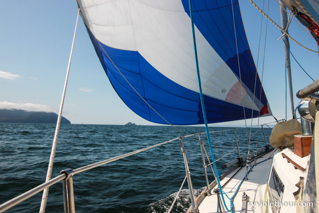
Flying our spinnaker approaching Brooks Peninsula and Solander Island
Inflow winds:
A tactic we learned this year is that most of the sounds on the west coast have diurnal inflow winds, even when the ocean has no wind. The sounds are shaped like wind funnels, collecting and concentrating any wind coming in from the ocean, and also create their own wind through diurnal land warming (heating of inland areas by the sun draws cold marine air into the sound).
This was most noticeable in Quatsino Sound, Nootka Sound, Barkley Sound and Esperanza Inlet. This is useful to know because often as we entered a sound the wind would build by 5-10 kts. If we were struggling to sail in 4-6 kts out on the ocean, upon entering a sound we’d usually have a great downwind sail in 10-15 – although sometimes this would be pretty short because our route into the sound was only 3-5 miles.
This also meant being prepared for a sudden increase in wind, as when we were thinking of putting up the spinnaker entering Nootka Sound in 10 kts but were glad we didn’t when it quickly built to 22 gusting 25.
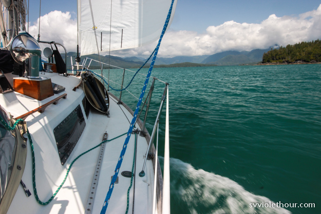
Riding inflow wind into Barkley Sound.
Wildlife
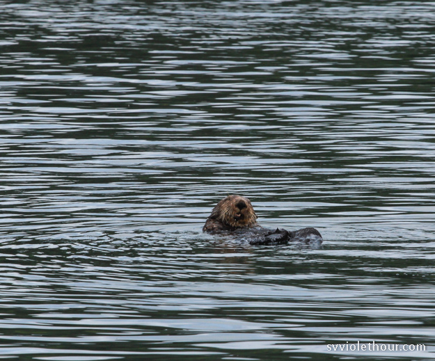
We saw a huge diversity of wildlife on the west coast of Vancouver Island. Most exciting for us was the many sea otters we saw. (Note: don’t confuse the common river otter with sea otters – sea otters are much cuter!). We spotted sea otters from the north end of the island (Nahwitti Bar) to Clayoquot Sound. The highest concentration was probably in Kyoquot Sound, where they were repopulated by human intervention a number of years ago.
We also saw them frequently in Quatsino Sound – usually one or two were hanging out in the harbors or anchorages. We saw 3 or 4 sea otters in Clayoquot Sound, which is more than we recall from our 2017 and 2015 trips there, and even one in the Strait of Juan de Fuca (we’ve never seen one that far south before).
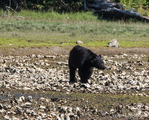
We saw whales as well of course, although not as many as prior years. Two rare marine animals we think we saw were: a sun fish, and a shark (possibly a salmon shark or basking shark, though the latter is very rare).

Nuisance Wildlife:
There were a lot of mosquitoes on the west coast this year! Pretty much every anchorage up and down the west coast had a few mosquitoes. Probably due to the wet weather – perfect breeding conditions. Mosquitoes are a nuisance on a boat because once they sneak in, they go into hiding until 4 am and then wake you up by buzzing around your ear and biting. Our mosquito defenses are pretty good but we have to keep our main hatch closed which is a pain.
A citronella candle doesn’t seem to help – they fly over it. We have screens on our dorade vents, but I discovered there was a gap they were getting in through and closed that up. Any 1/4” gap on your boat is enough for them to get in through. Another trick is spraying DEET inside the dorades – that prevents them from buzzing around in there annoyingly for hours and hours.
We did use our Thermacell mosquito repellent lantern which seems to work a little better. It also seems to work for yellow-jacket bees (which there have been a lot of this year, more so in the San Juans than the west coast).
There were also black flies in some anchorages, which are irritating because they bite occasionally.
Autopilot Report
It’s been 4 months cruising now with our new autopilot and we’ve been super thankful for it. We use it almost all the time when motoring and often when sailing, on longer days. The v2 mounting shelf has been holding up well and we can have complete confidence in the pilot’s ability to hold us on course (which wasn’t the case with our previous one, a wheel pilot).
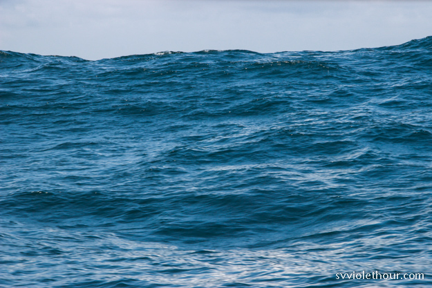
Big quartering swell with light wind is no problem for our new autopilot.
We’ve found a couple unexpected benefits. It makes keeping a watch easier because we can sit closer to the sidedeck when we don’t need a hand on the wheel. This is helpful when we’re dodging kelp snags, logs or crab pot buoys. And when we’re charting we don’t start driving a drunken course.
The other benefit is it cuts down on silly squabbling over whether the helmsman/woman is pinching, driving too deep, or luffing a telltale. If the steering is poor, there’s no one to blame but the autopilot. And generally its steering is better than either of us.
Timing
It took us 45 days just to go down the west coast of Van Isle (and about a month up the inside), at our slow cruising pace. Many people try to go around the whole island in a month, doing the west coast in only 2 weeks. To us that doesn’t seem nearly enough. It requires sailing (motoring) on a schedule, precludes exploring very far into the sounds, and leaves only a few buffer days for weather issues. With the weather we had this July, you could easily need 7 weather lay days. We spent at least 5 days waiting out strong southeasterlies, and spent 4-5 days slowing down to wait for wind.
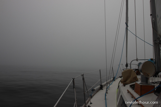
A big aspect of our timing was we wanted to avoid “Fogust”, the higher incidence of fog that occurs in August. This is why we aimed to round Cape Scott at the end of June. July gets a fair amount of fog too (we saw it in mornings about 1 out of 4 days) but after August 2, we did start getting more fog. We had some super dense fog in Barkley Sound that lasted until 2pm, and fog in the Strait of Juan de Fuca most days (sometimes not clearing till 3pm).
Conclusions
Once or twice a week Natalie and I would ask each other – “would we do it again?” And the answer kept flipping back and forth between yes and no. We had a few good sails, and a lot of boring motoring. And the weather often meant we couldn’t appreciate the beauty of the sounds we were in, because the view was obscured by dense low level clouds.
It is true though that the west coast is very remote, rugged and beautiful. And it’s a guaranteed source of adventure. Plus we love Barkley Sound, where the sailing is always good; but you don’t have to go around Vancouver Island to get there.
In some ways finishing the west coast of Vancouver Island was a milestone for us – not because it felt like a significant accomplishment, but because it didn’t. As sailors we were finally prepared enough and experienced enough that nothing was terribly difficult or harrowing. And that’s exactly how you want it to be. Four years ago if we had tried to do a full circumnavigation, some of those conditions would have been much more trying for us.
Despite doubts about whether it was worth it, one thing that was clear was we’re very fortunate to be able to see places like this. For the last year we’ve been practicing naming what we’re grateful for each day at dinner (inspired by two of our friends in Seattle who do this). We’ve found this helpful all the time, but especially on the west coast where the weather was often challenging and it can be isolating / lonely since there are so few people.
Our gratitudes spanned the gamut, to being grateful for the sun, the rain (occasionally), our boat, the autopilot, that we have the time to go on a sail like this, for wind, and for the beauty of British Columbia. There’s much to be grateful for, and a cruise like this certainly makes you recognize it.

At anchor in the Pinkerton Islands, Barkley Sound.
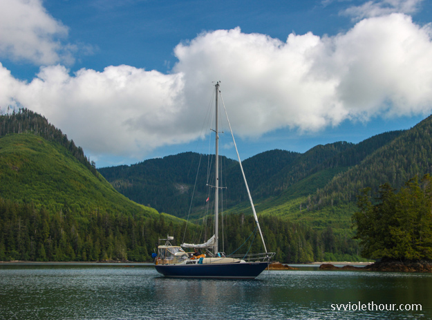
At anchor in Klaskino inlet, south of Quatsino Sound

The weather was bonkers this summer windwise. One of my friends was trying to sail an engineless boat down from alaska in July and was waiting 2 weeks for NW wind!
Exciting you saw a sea otter on the JdF! Hopefully they keep on recovering their population
Man, that would be tough. Was it an R2AK boat doing a return run? A few times I wished we had a pedal drive. Our diesel is easier of course, but it feels wrong sometimes.
Yes, on ziska – the slow boat from 1903m!
Oh wow, I was following them. They were the boat I thought had the most grit and crazy tough determination. It sounded like the crew was pretty burnt out from trying to row a really heavy boat, so hopefully they got a fresh return crew!
What were your main sources for weather information while on your VI circumnavigation?
We used the ECMWF a lot, through PredictWind or Windy, and Env Canada’s forecast thru VHF. There were many areas on the west side where we didn’t have cellular but I downloaded the 7-day in PredictWind whenever possible and often a 3 day old EC model still beat the Canadian forecast, due to greater granularity of data.