Circumnavigation is a term typically used for rounding the entire globe – but it can also be used for simply rounding an island. Boaters here often say they circumnavigated Vancouver Island, because that’s a significant accomplishment – Vancouver Island is a very large island. It would be perhaps a bit silly to say you circumnavigated a tiny island, like Blake Island, though.
Since we’re lacking in challenges now due to Canada being closed, we had the idea of circumnavigating Whidbey Island just for the fun of it. And it turns out Whidbey is actually quite a large island – the largest island in Washington and the longest island on the entire US mainland west coast (BC and Alaska have longer islands, but this is the largest one we can get to right now).
Going around Whidbey would mean we’d get to see the inside of Whidbey – including Deception Pass. This is the “inside” protected route to/from the San Juans, and one that motor boats often use. We’ve actually never been through Deception Pass though because we like to maximize sailing and were unsure about the opportunities for sailing on the inside.
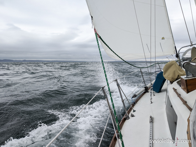
Conditions were pretty bumpy in the Rosario tide rip
If I wear my Canada hat, maybe they’ll let us in? 🙂
Now that we’ve done it we can say it’s quite possible to sail on the inside route, but there are a couple places where it’s very difficult to do so. Overall we motored about 25% more on the inside than on the outside. But we also got to see some new places.
We rounded Whidbey counter-clockwise, starting from Rosario Strait, crossing the Strait of Juan de Fuca to the Port Townsend area, and then up the inside northbound. In retrospect, it would be much better to round clockwise (starting by going through Deception Pass and then south on the inside) in typical summer-time wind conditions. On the inside we had north or westerly wind everyday, meaning we were upwind most of the time.
And the main place it’s very difficult to sail upwind is the 12-15 nautical mile stretch through the Skagit Bay channel to Deception Pass. The channel is only 0.25-0.5 nm wide, and the wind can either be non-existent or strong but very gusty and shifty.

Stats:
- # days underway: 9
- # days not underway (rest days / project days): 5
- % Sailed: 95% on the west side of Whidbey, about 75% on the east side
Route / Legs:
- Rosario Strait to Kala Point (between Port Townsend and Port Hadlock)
- Kala Point to Mystery Bay, Marrowstone Island to meet up with our cruising club, PSCC – it was really fun to see some people (from 6’ apart)!
- Mystery Bay to Port Ludlow
- Port Ludlow to Elger Bay, Camano Island
- Elger Bay to Coupeville
- Coupeville to Skagit Island / Hope Island area
- Skagit Island to Cornet Bay, Deception Pass state park
- Cornet Bay to Bowman Bay (also part of Deception Pass state park)
- Bowman Bay to cross our path in Rosario Strait
As you can see, we were in no rush and spent two weeks on this. There are several other options for stopping points on the route as well (ex, Everett or Langley could’ve shortened our 4th leg).

Kala Point (Port Townsend Bay)
Elger Bay, Camano Island
Elger Bay is just an indent in Camano Island, but provides surprisingly good protection from northerly wind. We sailed up to it in N 10-15 and within a few hundred yards to our anchor drop, the wind had dropped to 3-5.
The bay shoals rapidly so be careful you don’t run aground. It’s about 1 mile from the Camano Island State Park boat launch dock so in the morning we put the outboard on our dinghy to motor over and hike the trails. The beach and trails were great, but the marshy trails had a ton of mosquitoes – I got about a dozen bites. We were surprised to find mosquitoes out in force so early (end of May) – I guess the mosquito season this summer is likely to be a big one.
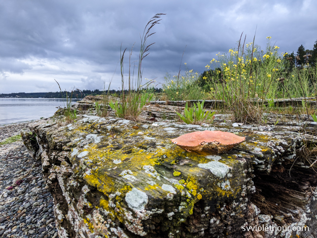
This photo is actually from Marrowstone Island (I don’t have any from Camano because I was too busy swatting mosquitoes)
Coupeville
We were unsure about stopping at Coupeville because boater reviews in Garmin were fairly negative. However we found it to be a very pretty sea-side town with an old-timey feel (it was established in the 1800’s and is a protected heritage site now). They’ve done a great job of preserving the historical aspects, and there are many flowers and orchards plus nice walking trails.


One other reason we were unsure about Coupeville is it can receive strong winds from JdF inflow. It’s separated from the Strait by only a relatively narrow strip of land and westerlies flow right over that. We were arriving with a W 15-25 forecast for overnight and the next day. There’s only about 1 mile of fetch to the Coupeville anchorage but that was enough for a 1 ft chop to develop in W 20 overnight. It made things pretty bumpy and noisy, but not a major problem – however we wouldn’t come back in a forecast over W 20.
Oak Harbor
We planned to go to Oak Harbor after Coupeville, since we could use some fresh groceries and thought it’d be better protected from the westerly. But as we sailed up to the entrance buoys in W 15-20, we could see the Oak Harbor anchorage was ripping. White caps running the length of the bay and possibly more wind than we had in Coupeville. Oak Harbor is oriented west to east, making it basically a landing strip for westerlies. And it’s not possible to tuck in behind any trees or points for protection, because shoals extend pretty far out from the western shore.
We didn’t really want to go into the marina and didn’t think the anchorage would be comfortable, so we bailed on Oak Harbor and continued sailing – downwind to Strawberry Point.
Skagit Island / Hope Island
Hope Island is a popular inside destination before Deception Pass because it’s a state park and has 4 mooring buoys. Those buoys were taken when we arrived though, so we anchored behind Skagit Island, south of Klakit Island. This provided pretty good protection from the westerly (which was still quite strong).
Unfortunately we didn’t get to visit Hope Island for hiking in the morning because a lightning and thunder storm arrived! (with heavy rain and wind as well)
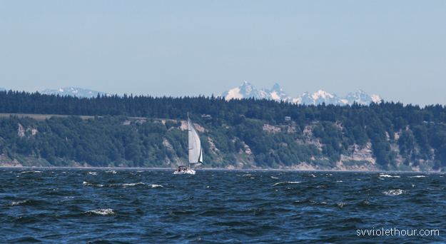
A photo of another boat sailing ahead of us on the west side of Whidbey
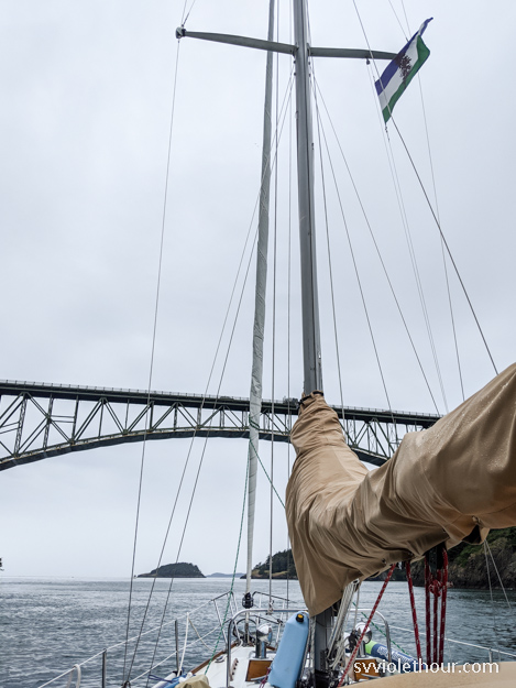
Deception Pass / Cornet Bay
We now had a westerly gale forecast for the Strait, so we were a bit trepidatious about heading to Cornet Bay / Deception Pass park but figured it’d be better than the Skagit Island / Hope Island area, which received almost the full force of the weaker westerly the day prior (W 15-20). It was fine at that level but we weren’t sure about 25-35 knots.
The state park floating docks at Cornet Bay (just east of Deception Pass) turned out to be great. The two docks can fit 4 boats each, and there were only 4 boats when we arrived. The next day (Sunday) there was only one other boat. The shore-side dock does get very busy with fisherpeople (that’s the non-gender-specific term right?). And we were entertained on Monday when dozens of trucks with fishing boats on trailers lined up in the parking lot to use the boat launch – apparently halibut fishing is open on Mondays, and this is a very busy boat launch.
Cornet Bay did get windy (about 15-20 knots) but it was no problem on the floating dock. There’s also room for anchoring, however I’d prefer the off-shore dock if available because there’s enough current in here to overpower the wind at times, and we get rolly when beam on to wind waves.


Deception Pass was definitely the highlight of our trip around Whidbey – the tall, forested hills and bluffs remind me a bit of BC, and there are many hiking trails through the forest which feel a bit like the Olympic National Park rainforest when it’s raining (as it was when we arrived). The strong currents passing through Deception Pass also remind me of BC, and create a rich sea life including kelp (which we don’t see too often in WA) and anemones.
Summary
We’re not sure we would take the inside route of Whidbey again. It felt like it took a lot longer and we weren’t able to sail as much as we do on the outside route. We definitely would come back to Deception Pass again, but we would do that simply by going in Deception Pass and then back out. The pass is only a mile or two long, is pretty close to Rosario Strait, and can be easily visited from SE Lopez Island or Anacortes.