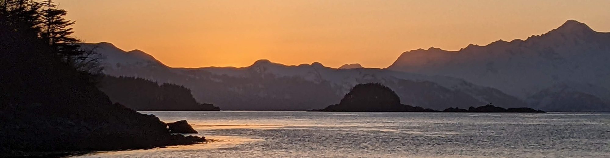
As we sailed past Cape Scott, the northwesternmost cape of Vancouver Island, a mix of elation, relief, and “is-that-it?” filled our heads. The passage we had worried about for so long ended up being kind of easy, and about half fun / half boring. That’s pretty typical of cruising though – things are never exactly what you expect, and they’re rarely perfect.
In a way, we’d been trying to get to Cape Scott for 10 days – but it also was a dream we’d had for at least a year. Rounding Cape Scott marks the beginning of our first full circumnavigation of Vancouver Island (although we’ve done 75% of it already during other cruises).
To be honest we almost bailed on our west coast plan again this year. Our plan was always “probably, maybe” and the awful swell against current that we hit in Hakai Pass in June very nearly deterred us. It was a reminder we don’t like sailing in PNW ocean swell, because the confused swell often destroys sailing ability if the wind is below 10 kts. And ocean swell here is rarely true ocean swell; it’s generally a worsened form – sharpened by currents, headlands and shallows.
But many, many people sail (or motor) around Vancouver Island, and we realized we could probably do it without too much misery – we just needed to be smart and wait for the right forecasts.
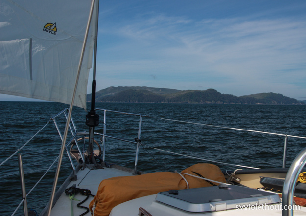
The two parts we stressed about on this leg were the Nahwitti Bar, and Scott Channel (the channel off Cape Scott). The Nahwitti Bar is a shallow 30-40 ft bar at the end of Goletas Channel where strong outgoing ebb currents can meet the incoming ocean swell (and wind, if it’s up), creating heaped up, breaking seas. We think we worried needlessly about this, because avoiding this condition turns out to be not very hard – go on the morning high water slack (also when the wind isn’t likely to be up yet, since it’s morning).

Motoring over the Nahwitti Bar in nice conditions.

The second part we worried about was Scott Channel, because up to 3 knots of current flows through there, with ocean swell from multiple directions, and the wind typically picks up at Cape Scott, especially in the afternoon. It’s not uncommon to hear the lighthouse report saying NW 20, 5 foot moderate seas. In our experience in other areas though, 5 foot seas with only 20 kts of wind are usually more rough than moderate – they likely got that way because of opposing current, which sharpens them and shortens the interval.
However we also had a great sail through Scott Channel, probably because if you cross the Nahwitti bar at high water slack, you arrive at Cape Scott with current and wind aligned. It also helped that we got there early – the wind had just started blowing towards 20, and hadn’t had time to build up a big fetch. In short, we lucked out with a really good weather window and sea state.
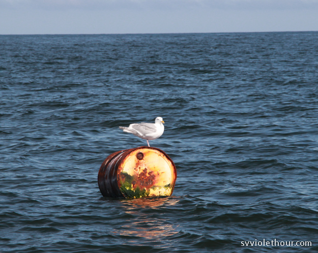
Bird on a barrel.
Sailor Beta: Trip Notes
With a ~7:15am slack at Nahwitti Bar we woke at 6:15am, raised anchor at 6:30 and reached the bar entrance at 7:00am so we’d be on the tail of the flood (no ebb colliding with the swell yet). We had a favorable backeddy along the north shore prior to the bar.
The bar itself had only 2 foot long interval swell and some confused chop, but not bad at all. After the bar we had a primary north swell of 3 feet or so and a secondary west swell. The East Dellwood buoy had only 0.9m swell in the morning, which is very good (E Dellwood is more typically 1.0-2.0m). Both swells were long interval, but motoring in no wind with swell on the beam made things a bit rolly.
The forecast was a bit more complex than usual: Q Sound was for E 5-15 transitioning to N 10-20 in the morning, NW 20-25 in the afternoon, and W Van Isle N was for N 10-20. But we only had about E 3-5 until near Cape Scott. Approaching the Cape we finally got some NE wind of about 8-10 and set sail on a reach (~120 degree) heading west. In Scott Channel we had a 1-2 knot favorable ebb current, and the sea state was surprisingly flat. Very pleasant sailing. As wind built to N 10-15 we had a nice downwind run.
For a while we were “racing” the southbound R2AK boat “Pitoraq.” But as they had their spinnaker up (along with a racing main), and we were lazy cruisers not flying a spinnaker, they gradually overtook us. They took a picture of us and were very kind to call on the VHF so they can email it to us!

The wind picked up to N 20 off Sea Otter Cove, and it was tempting to keep going, but since there’s 4 days of southerlies coming later this week (and we’re *not* going around Brooks peninsula in a 20-25 kt southerly!), we had some lay days to spend in Quatsino Sound.
Sea Otter Cove
As we arrived to Sea Otter Cove and grabbed a mooring buoy, Natalie remarked that it felt a bit anti-climatic. It was true, in a way, because the passage had gone so smoothly and easily – relative to the worst case scenarios we had worried about for the week prior. But not to worry because we still have Brooks Peninsula to contend with!
Sea Otter Cove is a very shallow anchorage – on a zero tide, the entry has less than 5’ depth in places. Fortunately when we went in at low tide, it was a 5’ low tide and the least depth we saw was 8’ (we have a 5’ draft). A sailboat after us however grounded on a charted shallow bar. Fortunately with a rising tide they just had to wait about an hour.
There are no sea otters at Sea Otter Cove. But we started seeing sea otters at the Nahwitti Bar, and many more at Quatsino Sound.

Weather Forecasting
After our Cape Scott rounding on June 25, the forecast changed to: Wed: SE 5-15, Th: S 10-20, F: S 20-25, Sa: S 20-25 diminishing to S 10-20. Four days of southerlies! Except Canada keeps changing the Wednesday forecast – it’s been NW 5-15, SE 5-15, SE 15, and light – so they don’t really have a clue what it’s going to be. It would be very helpful to have cellular or a sat phone now so we could access GRIBs.
For now we’ll be waiting out these southerlies. It’s said that once you reach the west coast of Van Isle, it’s all downhill (downwind) from there, but this is a big misperception. It’s true after the next four days of south wind it will likely change back to NW, but getting out of the five sounds (which typically have inflow wind) is also upwind work. So going down the west coast is not a downhill sleighride, although the odds are slightly in your favor.
Forecasting becomes more important for the exposed ocean transits, and in areas without cellular service (most of the coast) we spend probably an hour a day listening to the VHF weather reports. An extra challenge is that Canada has several wind reporting stations down / in-operational (Sartine Island, Addenbroke, Fanny Island, and South Brooks). There are other wind stations we can get by with, but it would be useful to have Sartine Island and South Brooks right now because they’re the only stations near us that provide hourly reports instead of reports that can be over 3 hours old.
Coming Up
June was a tough weather month, but we’re starting to feel the signs of summer – it’s warming up a bit, and we encountered our first mosquitoes of the year in Quatsino Sound.
One thing that’s been tough about this part of our cruise is that since we have exposed ocean sails every few days, we need to keep our dinghy (a PortaBote) disassembled and can’t easily explore anchorages. When we go to “passage mode”, everything on the boat gets tied down – the dinghy disassembled and stowed on deck, water toys like the paddleboard are deflated and stowed, high wind sails are pre-rigged, and our “passage box” is prepped with convenient snacks, seasickness pills, and devices for music / podcast entertainment.
Another big change from the Inside Passage is the anchorages are mostly empty, and the sailboat/motorboat ratio has inverted – so far we’ve seen 9 sailboats and 3 motorboats (of the cruiser class – there are plenty of fishing boats). On the Inside Passage it’s more like 75% motorboats, 25% sailboats. And the west coast has far fewer cruising boats, probably only one tenth of where we were before. We’re in remote territory now, and will be until we reach Hot Springs Cove in Clayoquot Sound.
Glad you had a great passage round! I wouldn’t be too disappointed that it wasn’t rough 😉
Thanks so much for your write up. I almost always sail solo and have been pondering the Van circumvent for about a year … hopefully this July. I did manage to get up to Barkley Sound last May/June and had a bit of an adventure with two separate storms , fog and biggest swells I’d ever seen … so have a bit of confidence building history but also know it can definitely get serious real quick . I sail a 1981 Shannon 38’ and was impressed at how it handled as that was my first time beyond the Straits of Juan de Fuca.
Congratulations on your save passage and smart preparation.
Tom