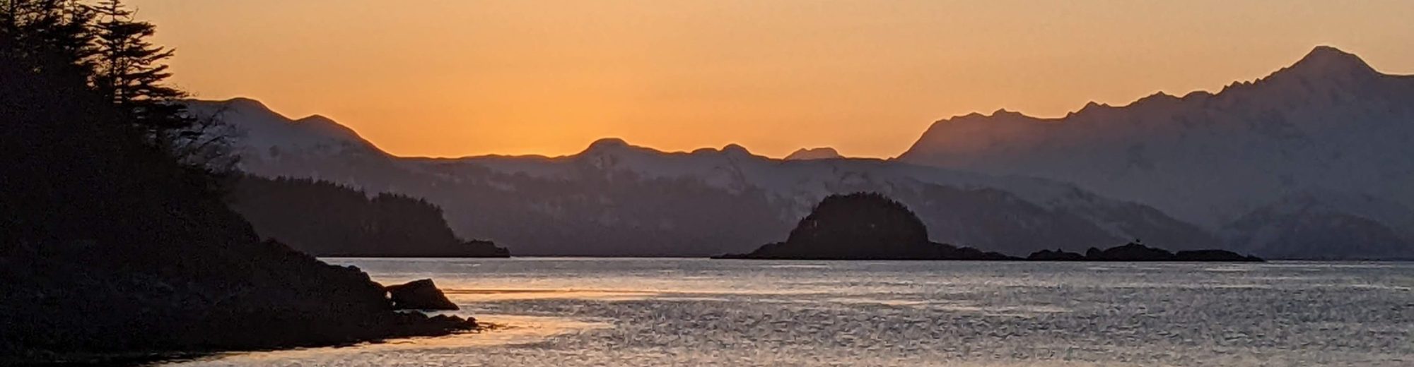
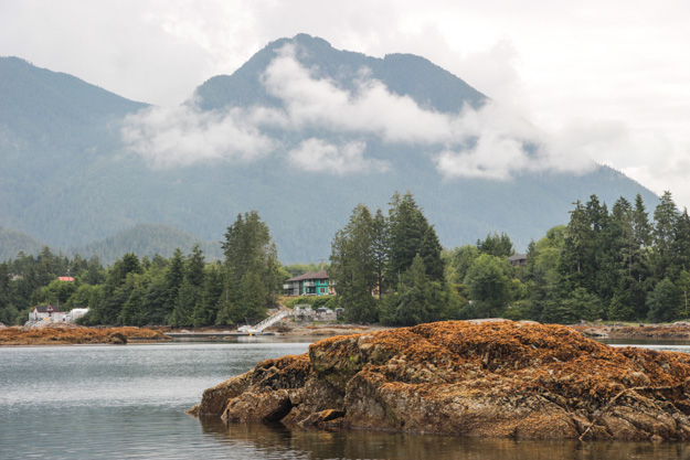
Week two of our July cruise began in Ucluelet, at the northwestern end of Barkley Sound. We anchored out in front of the main marina, after first filling our water tank at the 52 Steps dock, and emptying the holding tank at the pumpout station in the marina ($5 CDN). On the way into the harbor we saw a huge group of eagles (15-20) on the eastern shore, feeding on a salmon head.
We had dinner reservations for a date night at Norwoods, Ucluelet’s fine dining restaurant (a tiny town like this only has one). Everything was really good, and we’d recommend the steak and halibut entrees, and I was really impressed by Category 12 Brewing’s dry-hopped sour ale.
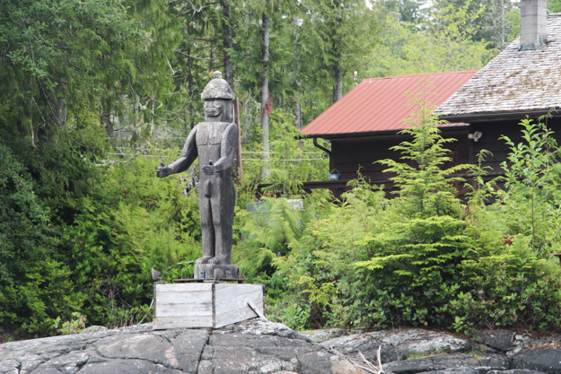
A First Nations statue outside Matilda Inlet
Attempting to go to Tofino and the (accidental) DSC Distress Call
Monday morning we disassembled the Portabote for storage on deck, since we knew there was a chance of big, rough waves on the way to Tofino. The forecast was iffy – a gale warning for Vancouver Island South, but that forecast region is enormous, and it sounded like the gale was primarily for the northern part (north of Estevan Point by Hot Springs Cove). We’re also often skeptical of Canada’s marine forecasts because we’ve found they frequently overestimate the wind compared to US forecasts – this time that may have been a mistake though.
We were prepared for some challenging upwind sailing, but the waves were the main concern. I was closely monitoring the reports from La Perouse Buoy, Lennard Island lighthouse station off Tofino, Estevan Point, Tofino Airport, and Cape Beale. We left Ucluelet early with very mild conditions in the harbor (2-4 kts SW) and Cape Beale reporting SW 8-10, which would be very good for us if it made it to Ucluelet. But as soon as we turned the corner out of the harbor, there was about 10 kt NW, but the waves quickly became the real problem.
The 6-9 foot waves from further out on the ocean were hitting this 50-60 foot depth region and stacking up into 5 foot standing waves. Standing waves are nothing like ocean swell – they’re unbelievably closely spaced waves that your boat doesn’t roll over, it dives over. Our previous 6 kts motoring speed got squashed to 2-3 kts by these waves, and the boat was pitching so much that I buried the bow, despite steering as best I could. These were probably the worst waves I’ve ever seen while going against them (going *with* the waves is much easier, and we’ve gone with comparable waves in the Strait of Georgia and Queen Charlotte Strait).
In all this commotion, the handheld VHF started beeping. Knowing we weren’t going to power through 5-6 foot standing waves very well at all, I turned us around, praying I timed it right so we wouldn’t be caught beam-on in a swell. Motoring with the swells was much easier, and we headed back to the protection of Spring Cove.
The VHF was still beeping, and it appeared to be making a DSC Distress call. Apparently our handheld VHF didn’t like the waves very much either. The Coast Guard was hailing whoever was issuing a DSC distress call, and given our VHF was in a “distress mode” I guessed that was me. I still have no idea how this happened – our handheld, a Standard Horizon HX870, requires pulling a flip switch and then pressing a button to activate a distress call, and that flip switch had never moved. In fact I have it taped shut so that it can never be accidentally triggered. My only guess is hitting those big waves which completely tossed the boat somehow tossed the VHF enough to cause an electrical glitch. I’m also unsure whether it may have actually been someone else’s VHF that initiated a distress call and our VHF was simply displaying that distress call.
Anyway, I was very apologetic with the Coast Guard and after a bit of confusion about whether it was really our MMSI which initiated it, we got it worked out.
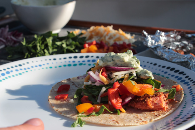
Salmon tacos for dinner – yum!
Spring Cove
Spring Cove is at the SW corner of the Ucluelet Harbor – it’s a good anchorage but there’s not much to do here, given there’s no shore access as far as I can tell (the former public dock is broken down, and it’s not clear whether the land there is private or not).
We turned tail and ran here after the big waves around the corner. I was feeling defeated, having only made it 2 miles closer to Tofino. Had we wimped out too easily? We know we can handle 20 kts upwind, but the waves here on the coast are the real problem.
It’s possible the waves would’ve gotten better after the Carolina Channel bar, but I knew they would still be bad. Wind readings later that day were 25-30, with 7-8 foot waves at 7 seconds (La Perouse Buoy + Lennard Island lighthouse obs). 7-8 foot waves at 7 seconds is an extremely steep wave pattern. So we made the right decision. Still, it’s tough to turn back.
On the upside, I turned it into a project day, doing some boat cleaning, replacing our water filter, and installing a new radio receiver which had been sitting in its box for 3 weeks.
Tofino
Tofino is sometimes a tough place for recreational boaters. On the one hand, it’s a super cute small town with a terrific surfer and hippie culture, good food and good beer – but on the other hand, a few factors make it difficult for visiting boaters. There isn’t much marina space, most of it being reserved for commercial fishing vessels.
We had hoped to get into the 4th St Dock marina, since it’d been a week since our last time on dock and we had laundry, groceries and other errands to do. But it turned out there was a fishing derby in town this week and the marina was quite full. The marina manager had actually gone home for the day so we weren’t able to reach anyone on the office phone or VHF.
We anchored out – but there’s the other tricky part – Tofino is a challenging anchorage, since 2+ knot currents run through it and there are tidal bars throughout the harbor that you need to avoid. We attempted to set in 40 ft but our Rocna, normally an instant set, took 100 ft or so to set in the current and we ended up in a 50 ft depth area. The next morning I had to raise 150’ of chain by hand and nearly every single section was covered in seaweed and entwined in kelp.
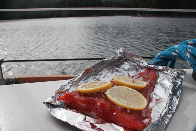
We visited the Tofino Brewery – always a favorite, and worth the 25 minute walk. We also got groceries at the Co-Op – surprisingly, there were all out of salmon. We had planned to stock up, since we’ve been unsuccessful in fishing attempts, but ended up finding some Chinook at Trilogy Fish Company by the docks of Tofino Resort + Marina.
Matilda Inlet
Matilda Inlet is a favorite of ours from two years ago. We were the only boat anchored here. We had managed to sail about half the way, after the narrow shallow channels from Tofino. The wind backs to southerly once into the main channel, so we had a nice downwind sail for the last part.
Matilda Inlet is relatively unremarkable to experienced boaters – if you consider evergreen trees in all four directions, with eagles soaring overhead as unremarkable. And that’s exactly what makes it appealing to us. It’s simple, quiet – a retreat and respite from the relative commotion of Tofino.

Amazing chicken masala and naan Natalie made
Technical Glitches
This year’s trip has been going really well – no major boat problems, no engine issues. I’ve had a few minor projects going on – the rig tune wasn’t perfect after our rerig this winter and I had to tighten the main shrouds. I installed a mast gate, which covers up our sail track slot and would allow us to lower the sail all the way for easier reefing (without having to remove a sail track stop) – but the mast gate didn’t work well, and I’ve had to remove it.
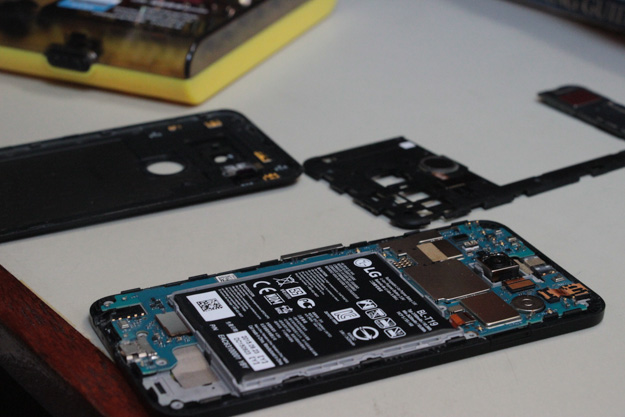
The biggest breakage actually has been my Android Nexus 5x phone – which mysteriously just turned off while we were walking back from Tofino Brewery and never worked again. It had 80% battery, but hasn’t responded to numerous reboot, reset, and charging attempts. This was our only Internet source, and a backup navigation device (Navionics).
The loss of Internet for recreational purposes (blogging, email) isn’t a huge loss, but it is for sailing purposes. We can get weather reports through VHF, but the recorded voice on VHF weather goes really slowly and takes about 15 minutes to get through one cycle – if you miss the one number you needed, you have to listen for 15 minutes again. There’s also no way to get a 24 hour history of the buoy readings, which we use to extrapolate wind conditions based on the prior day and today’s trend. All that data was really helpful previously in deciding when to go out onto the ocean.
Coming Up
We’re heading to Hot Springs Cove next, and thinking about rounding Estevan Point for Nookta Sound.
[Note: Already did that – posts are 1-2 weeks delayed due to lack of cell phone. Currently in Tofino, southbound tomorrow.]
But how was the sail when you finally got out of Uceulet? All that build up and then poof, you are suddenly in Tofino… It’s like the whole post was clickbait 🙂
But I suppose that’s just the jealously speaking.
Sorry! Don’t know how I forgot that. Maybe because it was relatively uneventful / interesting. Waiting a day made all the difference in sea state, making for much better swell conditions. No wind for a while unfortunately so we had to motor about 3 hours and then set sail upwind in 7-10.
Sailed into the harbor because the wind backs for a nice downwind run as you approach Tofino.
Closest I came to puking last summer was that bit between Uceulet and Tofino.
We also found Tofino challenging – couldn’t find anywhere to anchor in town so had to go around a mile away to a really rolly anchorage.