Upon departing Sea Otter Cove, we had 18 nautical miles of ocean coastal sailing to do, followed by 3-4 nm into Quatsino Sound. After a lot of motoring to get to Cape Scott, we were hoping to sail all of the 18 nm. But it was not to be.
We had a very confusing forecast (it changed four times, pretty much every 3 hours), but the latest was S 15. We can sail upwind fine in 15 knots, so we left in the morning with about S 4-7 up, sailing at 4 kts for a couple hours in gentle swell. Then the fog set in and the wind disappeared. It was some of the densest fog we’ve seen, reducing visibility to near nothing.
No fun. Fog is very tiring because you have to keep a constant watch – even though we were running radar, at any moment a small fishing boat or log could pop out of the fog.

So we ended up having to motor about 2/3’rds of the way to North Harbor, our anchorage in Quatsino Sound. So far my fear of going to the west coast equaling having to motor more has been looking true. In the two days from Bull Harbor to Quatsino Sound, we motored 7 hours, which is more than we typically motor in a week. We’re keeping our fingers crossed for better sailing soon though.
[This post covers June 26 thru June 30, 2019.]

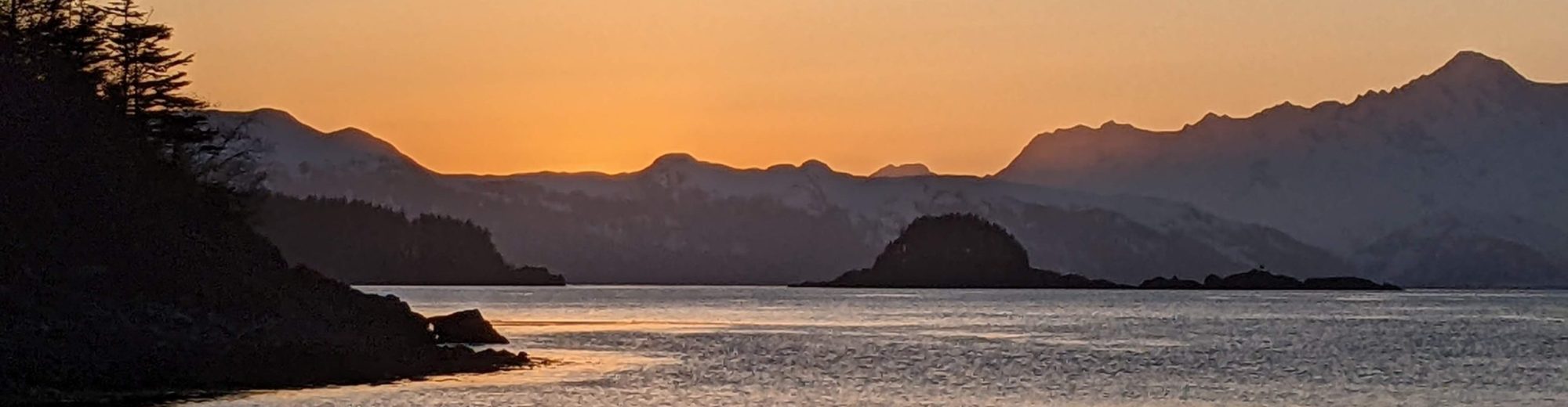
North Harbor
North Harbor is the closest anchorage upon entering Quatsino Sound, and had good views to the north and east. A sea otter had made his home in the reef to our west, so we had great views of him swimming around and feeding.
Winter Harbor
Winter Harbor is a small fishing community and has docks and a small store. We stayed at the public dock, which has water but no power (unless you get a 100’+ extension cord). Winter Harbor also has diesel, which is important because we may not have another chance to get fuel until Tofino, a couple hundred miles away. There are a couple other spots for fuel but they’re deep up inland inlets.

Winter Harbor public dock
They have paid wifi but at $15 for 300mb, it felt crazy expensive (the same amount is $3 on our cellular provider). There’s no cellular coverage in Winter Harbor (or North Harbor). However we had caught a brief LTE cellular zone just off the lighthouse at the entrance to Quatsino Sound. So the next day we headed out there and heaved-to for an hour.
And that is how this blog post got to you – heaved-to off the Quatsino Sound lighthouse.
Cell service is rare on the west coast, and while we like being disconnected from the Internet, it can get tough after a week of no data. We use it for weather data and staying connected with the cruising community. There are very few cruisers on the west coast, so it can get lonely – having Internet occasionally helps to feel in touch.
The store at Winter Harbor has mainly canned and dry goods, beer and alcohol, but very little vegetables or fruit. We bought some lettuce but it turned out to be moldy inside. Good thing we provisioned well at Port Hardy, considering it’s a week more before our next provisioning stop (Walter’s Cove)! Another option nearby is Coal Harbor, but it’s a 30 nm motor round-trip.
An unexpected plus to Winter Harbor was it has a nice boardwalk for walking along, extending about 1/2 mile along the shore. The boardwalk reminded me of Bamfield in Barclay Sound, although a bit dilapidated in comparison. There’s also a short forest hike behind the Outpost store.

Quatsino Sound has lots of sea otters, and they’re one of our favorite PNW marine animals (a lot more fun than whales), so we enjoyed watching them for hours on end. They eat, a lot.

Winter Harbor to Klaskino Anchorage
We departed Winter Harbor with a SE 10-20 forecast – not ideal, but better than the next day which was for no wind. We sailed upwind for about 5 hours, making good time to Klaskino anchorage about 25 nm of tacking to the south. It felt good to sail anchorage to anchorage, something we hadn’t been able to do yet since coming to the west coast.

Getting around Kwakiutl point (by Lawn Point) was a bumpy rodeo ride – the swell was very confused and stacking around that point (as we had expected, based on a report from S/V De Novo). With 15-17 knots of wind it wasn’t too bad though and things got better in Brooks Bay.

A view of Brooks Peninsula (with Solander Island at the right edge) on our sail to Klaskino anchorage.
We dropped the hook in 22 feet of water (on a 5’ tide) in the inner cove of Klaskino anchorage. It was quiet, calm, had song birds singing, and not another boat in sight. Then the rain started. No matter, it was still a beautiful place as the mist and clouds closed in.
Our guidebooks had hinted that Klaskish Basin, to the south, is nicer / preferable because it hasn’t been logged. But we found Klaskino to be scenic as well, without much evidence of logging. There’s bright green new growth forest covering the hills, and few or no bare logging scars. The main reason we chose Klaskino is it provides a much better sailing angle to Brooks peninsula when we leave; Klaskish turns the Brooks Peninsula into a lee shore, which would probably mean just motoring in the morning. (note: it’s easy to get the names of Klaskino and Klaskish confused! Here’s something that might help – the one to the north, Klaskino, ends in –no).

The next morning dawned sunny so I took the paddleboard out and explored the islets, lagoons and kelp reefs of Klaskino anchorage. It was so quiet out that the faintest sounds reached the ears distinctly – song birds singing, a distant wave breaking on a reef, and the faint buzz of bumblebees searching out flowers. Klaskino was one of those anchorages where you feel like you’ve found a really special, beautiful place.

Coming Up
We’re spending two nights at Klaskino anchorage to wait for the wind to come from the northwest. Then we have a forecast of NW 10-20 which should be about perfect for rounding the Brooks Peninsula.