Gwaii Haanas is a protected area of Haida Gwaii, encompassing hundreds of small islands, forested mountains, and the Haida heritage sites. Few cruisers visit it, because of the time and effort of getting across Hecate Strait. We were pretty excited to be heading there after waiting out 5 days of gales in Sandspit.
The highlights for us were the beautiful hot springs at Hotsprings Island and SGang Gwaii (a UNESCO world heritage site with amazingly well preserved poles).

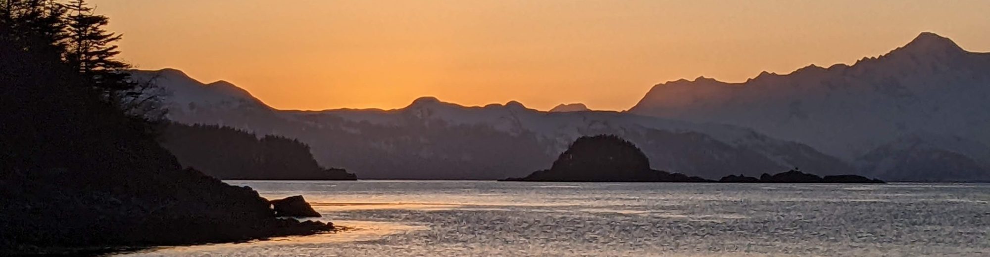
Thurston Harbor
First we headed to Thurston Harbor, which is not within the park boundaries but was a great anchorage after a long day. We saw our first bear (this year) here, in the evening about 8pm – a Haida black bear grazing along the grassy shore. It was too far away to get a decent picture.

Windy Bay
Windy Bay is the first Haida site inside Gwaii Haanas park that we visited. The watchmen were friendly and took us on a hike where we saw some really big old cedars. Windy Bay was the site of logging protests many years ago, which led to the establishment of the protected park and logging ban.


The anchorage is a temporary anchorage only – even for a calm day on Hecate (low swell and 6-8 kts wind) it was rolly in there. After Windy Bay we moved on to Hotsprings Island where we anchored for the night between Hotsprings and House Island.
Hotsprings Island
Hotsprings Island is one of the highlights of any cruiser’s trip through Gwaii Haanas park, and we visited the hot springs that evening and the following morning. The hot springs lost some water flow in the 2012 earthquake, but two pools are back and a 3rd one (the big cliff one) is starting to get some slow warm water flow.

The hot spring pools are built with man-made retaining walls to capture the warm water, and the Haida watchwomen here drain and clean the pools periodically. The pools have fantastic views of the mountains on a clear day. We felt these hotsprings were better than the ones at Hotsprings Cove in Clayoquot Sound.
Unfortunately on our morning return we were shocked to see the fishing vessel that had anchored there last night was underwater, just the deck and outriggers protruding above water. It turned out they had anchored too close to a rock and as the tide went down (12 ft tidal swings here), it canted their boat over and it filled with water.

The crew were all safe on shore, but it was very sad to see and there wasn’t anything we could really do to help. They were waiting for the Coast Guard to arrive. On our way out we saw the Coast Guard “Cape Mudge” vessel arriving from Sandspit, and later saw a really big Coast Guard cutter coming from Hecate Strait. It put a damper on our day, and was a reminder of how careful we must be in these remote areas.
As we sailed away from Hotsprings we also saw a sailboat in the distance heading towards it. With the binoculars I could just make out the cutter rig and what looked like a decal on the bow, so I knew it was probably S/V Dogbark, traveling with M/V Hula Girl. Dogbark is heading to the Northwest Passage and we’ve been following their progress through Halcyon Wandering’s Instagram. We had been hoping to run into them, and at least got to chat over the VHF.
Bag Harbor, near Dolomite Narrows (Burnaby Strait)
The Sound on the way into Bag Harbor had an outflow wind, but we managed to sail upwind most of the way in. Bag Harbor was our destination because it’s near Dolomite Narrows (sometimes called Burnaby Narrows, adjacent to Burnaby Island). The Narrows are a shallow area (less than 2 feet at low tide typically) with a fair amount of water flowing through it, creating rich conditions for sea life growth – anenomes, sea stars, sunflower stars, etc.

We stayed in Bag Harbor two nights because there was another southeast gale rolling through – Hecate Strait had 30-35 knots and we had gusts to 20-25 in our anchorage, but it was a good spot to ride it out. We stayed inside that day though because it was gusty and blowing sideways rain. The next morning we put the motor on the dinghy and explored the Narrows.

How to make the best of a rainy day: have a really good happy hour.
We saw plenty of anenomes, but not much else. I’m not sure if it was due to the relatively low visibility (an overcast day and somewhat murky waters) or if Dolomite Narrows is just overhyped. The Gwaii Haanas guide said it has some of the highest concentrations of marine life in BC, and showed pictures of sea stars and sunflower stars, but we didn’t see any sea stars at all (despite transiting near low tide).

Bag Harbor, with a ketch carrying charter guests to visit the Narrows, and our little boat in the background.
But honestly we’ve seen more marine life in marinas on the dock pilings. Also in many anchorages while paddleboarding (Growler Cove in Blackfish Sound had a magnificent sunflower star, Discovery Passage near Campbell River had lots of sea stars, anenomes and urchins, and Kayak Cove on the North Coast had lots of those as well – plus sea cucumbers).
So if you really want to see underwater sea life I’d say Burnaby Narrows isn’t worth the side trip. But, Bag Harbor was great and we explored Island Bay to the north which was very pretty.

Exploring Island Bay.
Ikeda Cove
The next day we moved to Ikeda Cove on the southeastern side of Gwaii Haanas. It faces Hecate Strait but is well protected by a long narrow entrance. We sailed 90% of the way there, lucking out with an outflow wind which allowed us to sail downwind. The cove has a grassy marsh area where we saw 4-5 deer grazing.

In big coves like this our boat often looks really small! We were the only boat here, and soaked in the silence and wildlife.
SGang Gwaii
The final destination was SGang Gwaii, a remote island at the southern end of Gwaii Haanas where the best original Haida poles can be seen. Getting there was a long motor – 5 hours + 2 hours to our anchorage afterwards – because the forecasted NW 10-20 knots never showed up (we had 0-6). The temporary anchorage at SGang Gwaii is marginal (poor holding) and exposed to swell, so we were glad it was a calm day.
We joined a group of fly-in tourists on a tour with the Haida watchman who was also a Haida historian. The Haida traditionally preserved their culture through storytelling – having no written language – and the historians were responsible for being able to perfectly retell their stories and history.

The poles were indeed the most well preserved we’ve seen. And there were so many of them – more than I expected. It was pretty cool to see them all in one place and imagine how life here was a few hundred years ago (before first contact with Europeans).


Heater Harbour
Heater Harbour is on the east side of Kunghit Island and probably not very commonly used, but gave us a convenient jumping off point for crossing Hecate Strait (staying in Rose Harbor would’ve meant fighting current on the way out at 4am).

Orion Point, at the entrance to Heater Harbour, had a cross – not sure why.
We went to bed exhausted from a long day, but had trouble sleeping after the busy day and with the anticipation of a long Hecate Strait crossing tomorrow. Stay tuned for a post on what happened with that!