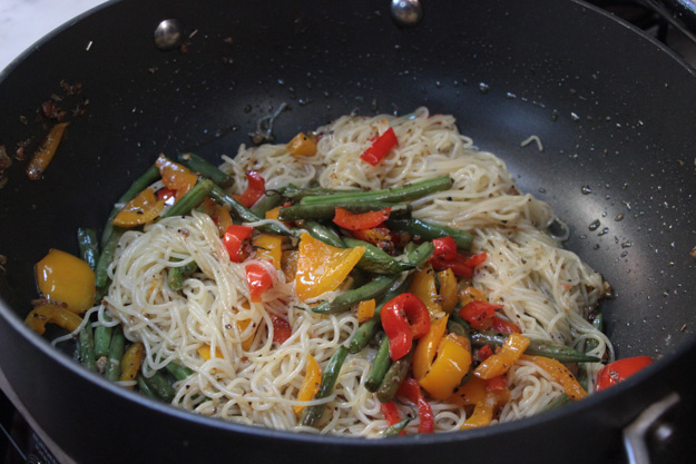
Our arrival to Barkley Sound was a tremendous relief – after bashing and motoring upwind for 200 miles, we were ready for some relaxation and easy sails between idyllic anchorages. Barkley Sound had all that and more. We sailed between every anchorage, attempted some fishing, went swimming in a waterfall creek, hiked Brady’s Beach, made pizza and cookies, and had a dinner out in Ucluelet.

Our route through Barkley Sound: Dodger Channel to Bamfield to Jacques-Jarvis Lagoon to Refuge Is (Lucky Creek) to Ucluelet

Refuge Island anchorage near Lucky Creek
Dodger Channel
The first night we were getting in around 7pm after a tiring day of motoring/sailing since 9:30am from Port Renfrew, so we decided to stop at the first available good anchorage – Dodger Channel. This isn’t an obvious anchorage, so we were the only boat there, but our guide book described it well, and a user report on Navionics has it rated 5 stars. It has a narrow, shallow (12 ft when we entered) south entrance which provides complete protection from waves, and is surrounded by scenic shoreline on all sides. In the morning a deer grazed on the grass to the north, and we rowed the dinghy to the south shore on Diana Island to explore the beach.
Bamfield
Bamfield was a short 3 nm away, so we sailed over with 8-10 kts behind us. Bamfield is a small town, with many super cute houses along the western shoreline on the boardwalk. We visited the general store and in the morning we did the walk to Brady’s Beach. Brady’s Beach was well worth it, and it was good we went near the morning’s low tide – this gave us easier access to the full length of the beach. It has tall sea stacks that reminded us of the Oregon town Astoria where the Goonies was filmed.
Around noon some wind was up so we sailed off anchor and over to Imperial Eagle channel to head to Jacques-Jarvis Lagoon.
Great Sailing in Barkley Sound
First a side note on the weather – the high pressure system that made our exit from the Strait so difficult is making for great sailing in Barkley Sound, and beautiful sunny afternoons. The NW wind funnels into the sound, becoming W/SW in most places, which makes for a lot of beam reaching and downwind sailing. After 5 1/2 days beating upwind, sailing on a beam reach was simply glorious.
The distance between anchorages in Barkley Sound is short – we only had about 9 nm to do from Bamfield to Jacques-Jarvis. And a 15-25 kt northwesterly out on the ocean is no problem inside the sound, because there it’s a perfect 15, to 10 in between islands, with mostly flat waters. The anchorages are all well protected, and mostly empty (as long as you avoid Effingham).
The wind in an extended high pressure system has also been very reliable and predictable – mornings are overcast and windless, then the wind starts around noon or 1pm, the skies clear to blue + sunny, and the wind lasts until 6-8pm. This makes it easy to time sailable passages between islands.

Jacques-Jarvis Lagoon
Jacques-Jarvis Lagoon is a tricky entrance – shallow and narrow, with rocks to avoid in several places. For this reason, not many boats enter it, and sailboats need to do so near high tide. We had an 8 foot tide, 1 hour past high tide, and did fine. Below is a screencap of our route. Basically it’s simple – have a bow lookout and don’t run into the rocks.

Our route into the lagoon. The last rock, which it looks like our path went over, is mischarted – it’s actually much closer to the other two rocks (closer to the center island).
As soon as we arrived, two hummingbirds flew over to investigate our boat. These visitors were welcome, but later got a bit tiresome – 5-6 hummingbirds buzzed around our boat for 4 hours, investigating anything with a bit of red on it (our American flag, tablet holder, main sail sheet, etc). Hummingbirds are pretty, but not the smartest creatures.
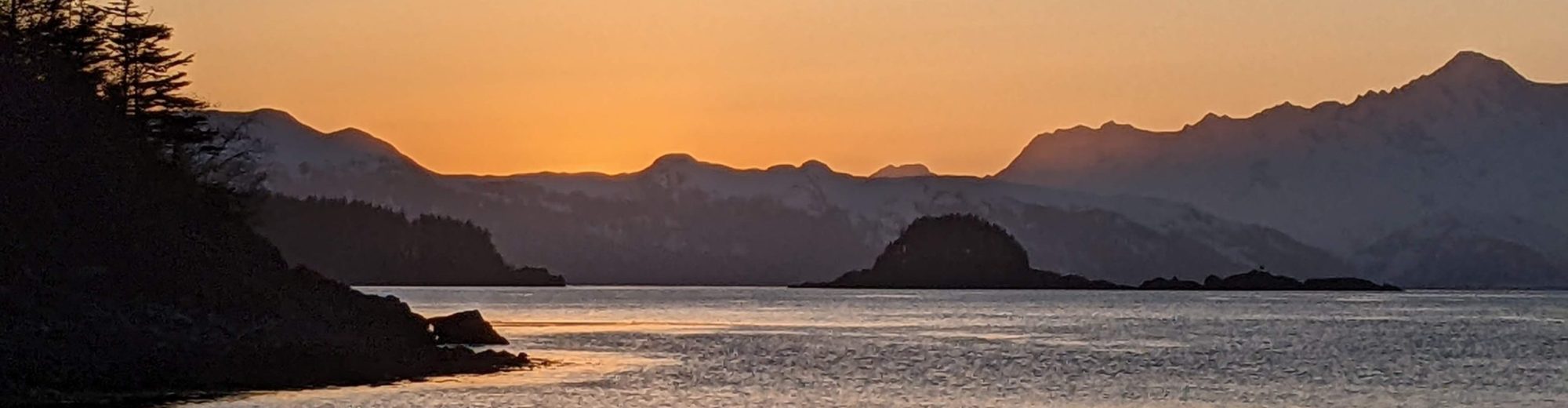
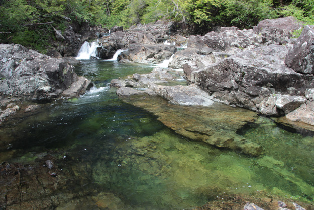
Refuge Island and a Magical Trip up Lucky Creek
The next day we sailed over to Refuge Island, at the start of Pipestem Inlet, to visit the waterfall at nearby Lucky Creek which had been highly recommended.
Lucky Creek is about a 2 mile long river that feeds out to the saltwater, and at low tide the river delta is a marsh (impassable). So you need to enter near a high tide – we went an hour after high tide but still on an 8 foot tide, about 7 when we left. Our dinghy with a short outboard had no problem, being careful to avoid a shallow sandbar in one section, and then rowing for the last 200-300 feet.

As long-time PNW’ers we’re always skeptical when someone gushes about a waterfall – it’s just falling water after all, and waterfalls are a dime a dozen in the PNW. Perhaps we’re too cynical but I’ve never seen why people get so excited about them. But Lucky Creek didn’t disappoint. There’s something to be said for the adage that a reward worked for is worth more than one handed to you. A challenge in getting someplace makes it all the more valued.
Lucky Creek was like that. After working our way up the shallows of the river to come upon a waterfall with no one else present made it feel like something special, like we were discovering it on our own. We had to figure out where to secure our dinghy (not very simple since there’s current and the rocks weren’t easy to tie to) and then scramble up a short Class 4 rock face to get to the bathing pools at the top of the waterfall. But before long we had to leave so the dropping tide didn’t make our dinghy passage more difficult.


Refuge Island Anchorage
We ended up being the only boat staying the night in this anchorage, and it provided a 360 degree view of mountains in nearly every direction. We saw a black bear grazing on the beach in the evening. The water was so clear in the anchorage that we could see the bottom at 15 feet. This was a bit disturbing since seeing the bottom is so uncommon in the PNW that it’s usually a sign you’re about to run aground.
The next morning at the 2.2 ft low tide, we found we *had* nearly touched bottom – our 5 foot draft had only 1/2 foot clearance from an uncharted rock just off our stern. In our quest to get snug into shallower anchorages (since we have a manual windlass), we’d gotten a tad too close to the islets our guidebook recommended anchoring near. No harm done, but I added a user submitted marker to Navionics for the uncharted -3’ rock.
Refuge Island did have one downside to it – mosquitoes, our arch nemesis from last year on the Sunshine Coast. As soon as they arrived around 5pm, we closed up the boat (with two hatches open with mosquito nets – but, it still makes it really hot inside!). Still, I got one or two bites, killed one, and one got inside which I nabbed an hour later.

Coming Up
After leaving Refuge Island / Lucky Creek, we sailed upwind to Ucluelet, again doing a little fishing along the way (no luck!). Ucluelet was our staging point to head back out into the ocean for the passage to Tofino.